Mount Haggin Topo Map Montana
To zoom in, hover over the map of Mount Haggin
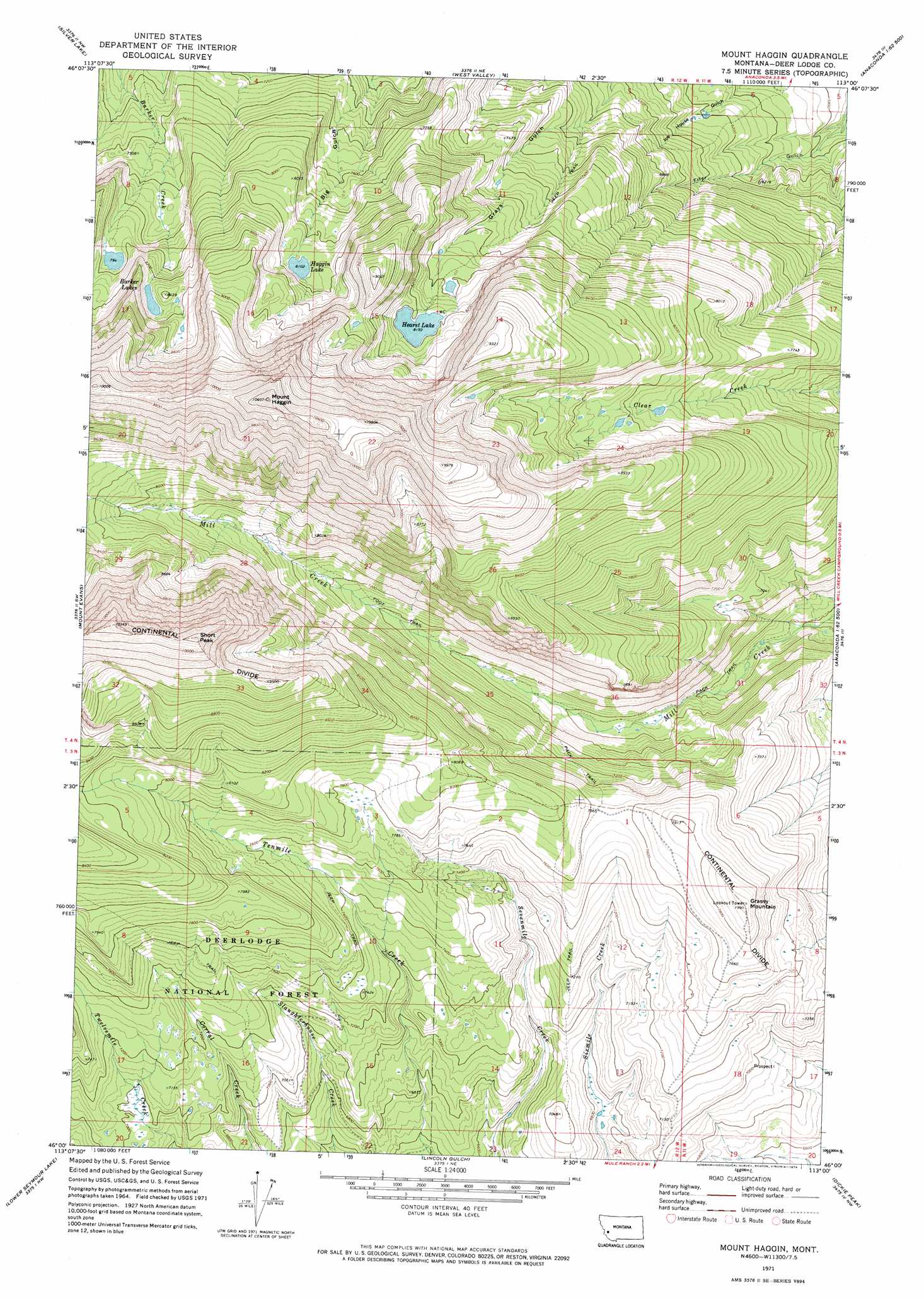
USGS Topo Quad 46113a1 - 1:24,000 scale
| Topo Map Name: | Mount Haggin |
| USGS Topo Quad ID: | 46113a1 |
| Print Size: | ca. 21 1/4" wide x 27" high |
| Southeast Coordinates: | 46° N latitude / 113° W longitude |
| Map Center Coordinates: | 46.0625° N latitude / 113.0625° W longitude |
| U.S. State: | MT |
| Filename: | o46113a1.jpg |
| Download Map JPG Image: | Mount Haggin topo map 1:24,000 scale |
| Map Type: | Topographic |
| Topo Series: | 7.5´ |
| Map Scale: | 1:24,000 |
| Source of Map Images: | United States Geological Survey (USGS) |
| Alternate Map Versions: |
Mount Haggin MT 1971, updated 1974 Download PDF Buy paper map Mount Haggin MT 1996, updated 1998 Download PDF Buy paper map Mount Haggin MT 2011 Download PDF Buy paper map Mount Haggin MT 2014 Download PDF Buy paper map |
| FStopo: | US Forest Service topo Mount Haggin is available: Download FStopo PDF Download FStopo TIF |
1:24,000 Topo Quads surrounding Mount Haggin
Philipsburg |
Fred Burr Lake |
Pozega Lakes |
Mount Powell |
Racetrack |
Georgetown Lake |
Silver Lake |
West Valley |
Anaconda North |
Warm Springs |
Storm Lake |
Mount Evans |
Mount Haggin |
Anaconda South |
Opportunity |
Long Peak |
Lower Seymour Lake |
Lincoln Gulch |
Dickie Peak |
Burnt Mountain |
Pine Hill |
Foolhen Mountain |
Dickie Hills |
Wise River |
Dewey |
> Back to 46113a1 at 1:100,000 scale
> Back to 46112a1 at 1:250,000 scale
> Back to U.S. Topo Maps home
Mount Haggin topo map: Gazetteer
Mount Haggin: Dams
Hearst Lake Dam elevation 2499m 8198′Mount Haggin: Lakes
Barker Lakes elevation 2424m 7952′Haggin Lake elevation 2471m 8106′
Hearst Lake elevation 2499m 8198′
Mount Haggin: Summits
Grassy Mountain elevation 2434m 7985′Mount Haggin elevation 3233m 10606′
Short Peak elevation 3134m 10282′
Mount Haggin digital topo map on disk
Buy this Mount Haggin topo map showing relief, roads, GPS coordinates and other geographical features, as a high-resolution digital map file on DVD: