Mount Emerine Topo Map Montana
To zoom in, hover over the map of Mount Emerine
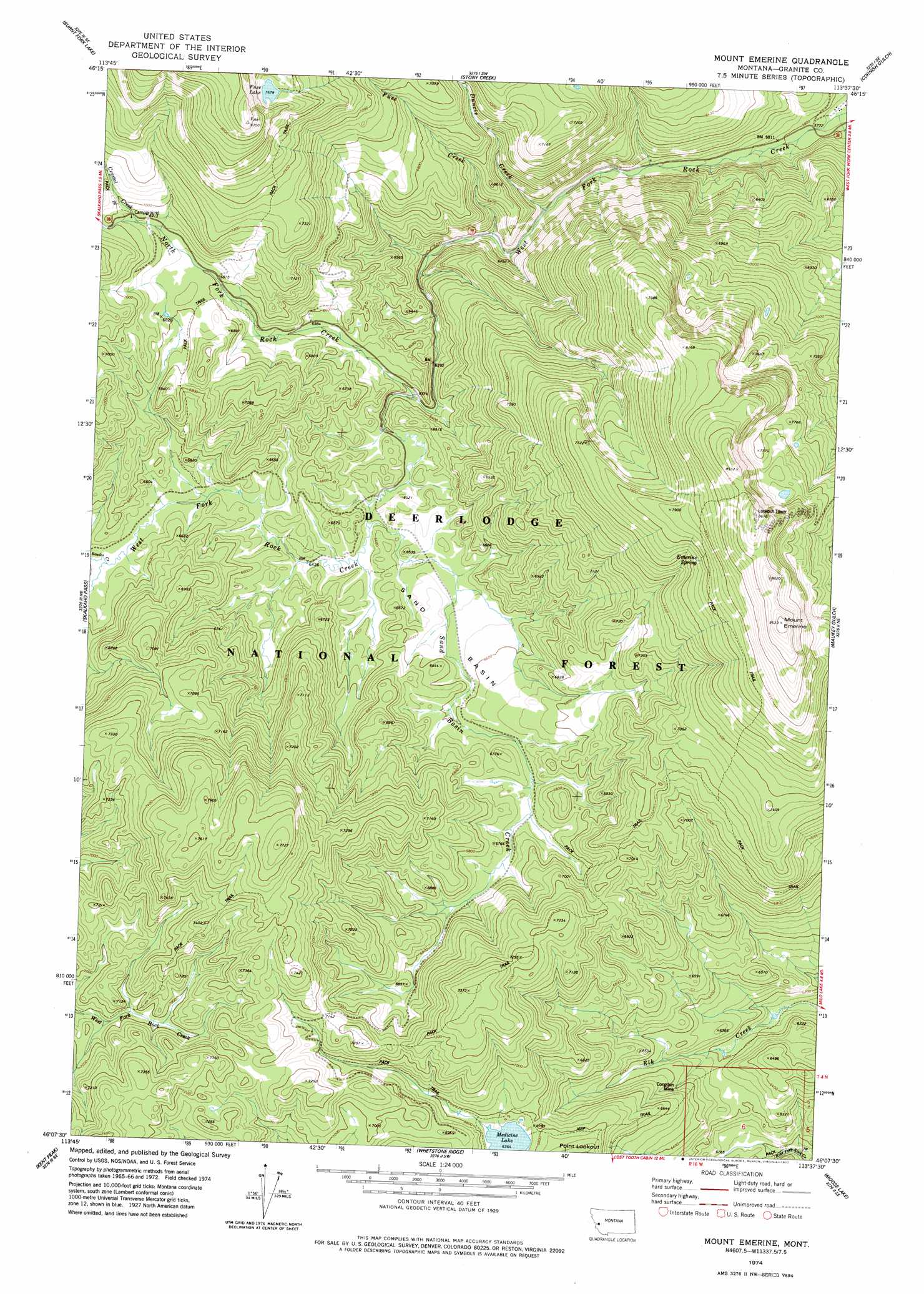
USGS Topo Quad 46113b6 - 1:24,000 scale
| Topo Map Name: | Mount Emerine |
| USGS Topo Quad ID: | 46113b6 |
| Print Size: | ca. 21 1/4" wide x 27" high |
| Southeast Coordinates: | 46.125° N latitude / 113.625° W longitude |
| Map Center Coordinates: | 46.1875° N latitude / 113.6875° W longitude |
| U.S. State: | MT |
| Filename: | o46113b6.jpg |
| Download Map JPG Image: | Mount Emerine topo map 1:24,000 scale |
| Map Type: | Topographic |
| Topo Series: | 7.5´ |
| Map Scale: | 1:24,000 |
| Source of Map Images: | United States Geological Survey (USGS) |
| Alternate Map Versions: |
Mount Emerine MT 1974, updated 1977 Download PDF Buy paper map Mount Emerine MT 1996, updated 1998 Download PDF Buy paper map Mount Emerine MT 2011 Download PDF Buy paper map Mount Emerine MT 2014 Download PDF Buy paper map |
| FStopo: | US Forest Service topo Mount Emerine is available: Download FStopo PDF Download FStopo TIF |
1:24,000 Topo Quads surrounding Mount Emerine
Corley Gulch |
Sawmill Saddle |
Quigg Peak |
Alder Gulch |
Black Pine Ridge |
Willow Mountain |
Burnt Fork Lake |
Stony Creek |
Cornish Gulch |
Antelope Creek |
Gird Point |
Skalkaho Pass |
Mount Emerine |
Maukey Gulch |
Potato Lakes |
Bald Top Mountain |
Kent Peak |
Whetstone Ridge |
Moose Lake |
Carpp Ridge |
French Basin |
Jennings Camp Creek |
Lick Creek |
Kelly Lake |
Warren Peak |
> Back to 46113a1 at 1:100,000 scale
> Back to 46112a1 at 1:250,000 scale
> Back to U.S. Topo Maps home
Mount Emerine topo map: Gazetteer
Mount Emerine: Basins
Sand Basin elevation 2002m 6568′Mount Emerine: Lakes
Fuse Lake elevation 2342m 7683′Medicine Lake elevation 2060m 6758′
Mount Emerine: Mines
Congdon Mine elevation 1959m 6427′Mount Emerine: Springs
Emerine Spring elevation 2368m 7769′Mount Emerine: Streams
Bowles Creek elevation 1983m 6505′Crystal Creek elevation 2110m 6922′
Duncie Creek elevation 1836m 6023′
Fuse Creek elevation 2170m 7119′
North Fork Rock Creek elevation 1939m 6361′
Sand Basin Creek elevation 1963m 6440′
Mount Emerine: Summits
Emerine Mount elevation 2630m 8628′Mount Emerine digital topo map on disk
Buy this Mount Emerine topo map showing relief, roads, GPS coordinates and other geographical features, as a high-resolution digital map file on DVD: