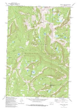
Pozega Lakes Topo Map Montana
To zoom in, hover over the map of Pozega Lakes
USGS Topo Quad 46113c1 - 1:24,000 scale
| Topo Map Name: | Pozega Lakes |
| USGS Topo Quad ID: | 46113c1 |
| Print Size: | ca. 21 1/4" wide x 27" high |
| Southeast Coordinates: | 46.25° N latitude / 113° W longitude |
| Map Center Coordinates: | 46.3125° N latitude / 113.0625° W longitude |
| U.S. State: | MT |
| Filename: | o46113c1.jpg |
| Download Map JPG Image: | Pozega Lakes topo map 1:24,000 scale |
| Map Type: | Topographic |
| Topo Series: | 7.5´ |
| Map Scale: | 1:24,000 |
| Source of Map Images: | United States Geological Survey (USGS) |
| Alternate Map Versions: |
Pozega Lakes MT 1971, updated 1973 Download PDF Buy paper map Pozega Lakes MT 1971, updated 1991 Download PDF Buy paper map Pozega Lakes MT 1996, updated 1998 Download PDF Buy paper map Pozega Lakes MT 2011 Download PDF Buy paper map Pozega Lakes MT 2014 Download PDF Buy paper map |
| FStopo: | US Forest Service topo Pozega Lakes is available: Download FStopo PDF Download FStopo TIF |
1:24,000 Topo Quads surrounding Pozega Lakes
> Back to 46113a1 at 1:100,000 scale
> Back to 46112a1 at 1:250,000 scale
> Back to U.S. Topo Maps home
Pozega Lakes topo map: Gazetteer
Pozega Lakes: Basins
Dempsey Basin elevation 2504m 8215′Finley Basin elevation 2411m 7910′
Pozega Lakes: Dams
Albicaulis Lake Dam elevation 2356m 7729′Alpine Lake Dam elevation 2404m 7887′
Bowman Lake Number 1 Dam elevation 2394m 7854′
Bowman Lake Number 2 Dam elevation 2438m 7998′
Bowman Lake Number 3 Dam elevation 2431m 7975′
Caruthers Lake Dam elevation 2405m 7890′
Fisher Lake Dam elevation 2286m 7500′
Goat Lake Dam elevation 2516m 8254′
Mountain Ben Dam elevation 2607m 8553′
Mud Lake Dam elevation 2490m 8169′
Pozega Lake Number 1 Dam elevation 2295m 7529′
Pozega Lake Number 2 Dam elevation 2348m 7703′
Pozega Lake Number 3 Dam elevation 2379m 7805′
Thornton Lake Dam elevation 2307m 7568′
Pozega Lakes: Flats
Indian Meadows elevation 2121m 6958′Pozega Lakes: Gaps
Racetrack Pass elevation 2599m 8526′Pozega Lakes: Lakes
Albicaulis Lake elevation 2356m 7729′Alpine Lake elevation 2404m 7887′
Caruthers Lake elevation 2468m 8097′
Dead Lake elevation 2348m 7703′
Elbow Lake elevation 2361m 7746′
Green Lake elevation 2386m 7828′
Hunters Lake elevation 2368m 7769′
Little Goat Lake elevation 2511m 8238′
Little Racetrack Lake elevation 2276m 7467′
Meadow Lakes elevation 2373m 7785′
Mud Lake elevation 2321m 7614′
Porcupine Lake elevation 2361m 7746′
Pozega Lakes elevation 2296m 7532′
Thornton Lake elevation 2311m 7582′
Trask Lakes elevation 2356m 7729′
Pozega Lakes: Mines
Powell Mine elevation 2570m 8431′Powell Mines elevation 2557m 8389′
Pozega Lakes: Populated Places
Danielsville elevation 1844m 6049′Tungsten elevation 2433m 7982′
Pozega Lakes: Post Offices
Daniels Post Office (historical) elevation 1844m 6049′Pozega Lakes: Ranges
Flint Creek Range elevation 1994m 6541′Pozega Lakes: Reservoirs
Albicaulis Lake elevation 2356m 7729′Alpine Lake elevation 2404m 7887′
Big Pozega Lake elevation 2296m 7532′
Bowman Lakes elevation 2394m 7854′
Caruthers Lake elevation 2405m 7890′
Fisher Lake elevation 2270m 7447′
Goat Lake elevation 2506m 8221′
Green Lake elevation 2379m 7805′
Little Pozega Lake elevation 2348m 7703′
Lower Bowman Lake elevation 2394m 7854′
Middle Bowman Lake elevation 2438m 7998′
Mountain Ben Lake elevation 2607m 8553′
Mud Lake elevation 2490m 8169′
Thornton Lake elevation 2307m 7568′
Upper Bowman Lake elevation 2431m 7975′
Pozega Lakes: Ridges
Thornton Ridge elevation 2624m 8608′Pozega Lakes: Streams
North Fork Racetrack Creek elevation 1971m 6466′Pozega Lakes: Summits
Racetrack Peak elevation 2855m 9366′Pozega Lakes: Trails
Boulder Lakes Trail elevation 2168m 7112′Pozega Lakes digital topo map on disk
Buy this Pozega Lakes topo map showing relief, roads, GPS coordinates and other geographical features, as a high-resolution digital map file on DVD:


