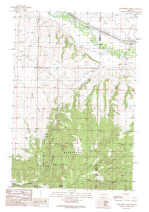
Dunkleberg Creek Topo Map Montana
To zoom in, hover over the map of Dunkleberg Creek
USGS Topo Quad 46113e1 - 1:24,000 scale
| Topo Map Name: | Dunkleberg Creek |
| USGS Topo Quad ID: | 46113e1 |
| Print Size: | ca. 21 1/4" wide x 27" high |
| Southeast Coordinates: | 46.5° N latitude / 113° W longitude |
| Map Center Coordinates: | 46.5625° N latitude / 113.0625° W longitude |
| U.S. State: | MT |
| Filename: | o46113e1.jpg |
| Download Map JPG Image: | Dunkleberg Creek topo map 1:24,000 scale |
| Map Type: | Topographic |
| Topo Series: | 7.5´ |
| Map Scale: | 1:24,000 |
| Source of Map Images: | United States Geological Survey (USGS) |
| Alternate Map Versions: |
Dunkleberg Creek MT 1989, updated 1989 Download PDF Buy paper map Dunkleberg Creek MT 1996, updated 1998 Download PDF Buy paper map Dunkleberg Creek MT 2011 Download PDF Buy paper map Dunkleberg Creek MT 2014 Download PDF Buy paper map |
| FStopo: | US Forest Service topo Dunkleberg Creek is available: Download FStopo PDF Download FStopo TIF |
1:24,000 Topo Quads surrounding Dunkleberg Creek
> Back to 46113e1 at 1:100,000 scale
> Back to 46112a1 at 1:250,000 scale
> Back to U.S. Topo Maps home
Dunkleberg Creek topo map: Gazetteer
Dunkleberg Creek: Crossings
Interchange 162 elevation 1261m 4137′Dunkleberg Creek: Dams
Goldberg East Dam elevation 1903m 6243′Goldberg West Dam elevation 1904m 6246′
Dunkleberg Creek: Mines
Forest Rose Mine elevation 1651m 5416′Jackson Park Mine elevation 1808m 5931′
SE Section 14 Mine elevation 1670m 5479′
SE Section 15 Mine elevation 1537m 5042′
SW Section 14 Mine elevation 1707m 5600′
Dunkleberg Creek: Parks
Jackson Park elevation 1815m 5954′Dunkleberg Creek: Populated Places
Haskell (historical) elevation 1239m 4064′Jens elevation 1257m 4124′
Dunkleberg Creek: Post Offices
Dunkleberg Post Office (historical) elevation 1509m 4950′Jens Post Office (historical) elevation 1257m 4124′
Dunkleberg Creek: Reservoirs
Goldberg Reservoir elevation 1903m 6243′Dunkleberg Creek: Ridges
Dunkleberg Ridge elevation 1721m 5646′Dunkleberg Creek: Streams
Bert Creek elevation 1228m 4028′Dunkleberg Creek elevation 1239m 4064′
Hoover Creek elevation 1251m 4104′
Perkins Creek elevation 1247m 4091′
Dunkleberg Creek: Summits
Lone Tree Hill elevation 1909m 6263′Dunkleberg Creek: Valleys
Coberly Gulch elevation 1235m 4051′Dunkleberg Creek: Wells
09N12W04BABB01 Well elevation 1354m 4442′10N11W19ACAC01 Well elevation 1250m 4101′
10N11W19BBBA01 Well elevation 1247m 4091′
10N11W20CACA01 Well elevation 1259m 4130′
10N11W20CADA01 Well elevation 1259m 4130′
Dunkleberg Creek digital topo map on disk
Buy this Dunkleberg Creek topo map showing relief, roads, GPS coordinates and other geographical features, as a high-resolution digital map file on DVD:


