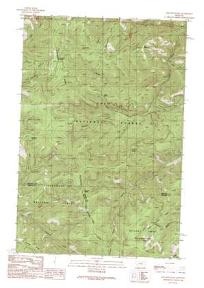
Elk Mountain Topo Map Montana
To zoom in, hover over the map of Elk Mountain
USGS Topo Quad 46113f7 - 1:24,000 scale
| Topo Map Name: | Elk Mountain |
| USGS Topo Quad ID: | 46113f7 |
| Print Size: | ca. 21 1/4" wide x 27" high |
| Southeast Coordinates: | 46.625° N latitude / 113.75° W longitude |
| Map Center Coordinates: | 46.6875° N latitude / 113.8125° W longitude |
| U.S. State: | MT |
| Filename: | o46113f7.jpg |
| Download Map JPG Image: | Elk Mountain topo map 1:24,000 scale |
| Map Type: | Topographic |
| Topo Series: | 7.5´ |
| Map Scale: | 1:24,000 |
| Source of Map Images: | United States Geological Survey (USGS) |
| Alternate Map Versions: |
Elk Mountain MT 1989, updated 1989 Download PDF Buy paper map Elk Mountain MT 1999, updated 2003 Download PDF Buy paper map Elk Mountain MT 2011 Download PDF Buy paper map Elk Mountain MT 2014 Download PDF Buy paper map |
| FStopo: | US Forest Service topo Elk Mountain is available: Download FStopo PDF Download FStopo TIF |
1:24,000 Topo Quads surrounding Elk Mountain
> Back to 46113e1 at 1:100,000 scale
> Back to 46112a1 at 1:250,000 scale
> Back to U.S. Topo Maps home
Elk Mountain topo map: Gazetteer
Elk Mountain: Gaps
Holloman Saddle elevation 1793m 5882′S and G Saddle elevation 1728m 5669′
Two Y Junction elevation 1742m 5715′
Elk Mountain: Populated Places
Eightmile Saddle elevation 1954m 6410′Yukon Saddle elevation 1581m 5187′
Elk Mountain: Springs
Last Drink Springs elevation 1787m 5862′Last Drink Springs elevation 1718m 5636′
Elk Mountain: Streams
Last Drink Creek elevation 1452m 4763′Middle Fork Swartz Creek elevation 1222m 4009′
North Fork Eightmile Creek elevation 1368m 4488′
West Fork Swartz Creek elevation 1121m 3677′
Elk Mountain: Summits
Elk Mountain elevation 1864m 6115′Elk Mountain: Valleys
Teton Gulch elevation 1210m 3969′Elk Mountain digital topo map on disk
Buy this Elk Mountain topo map showing relief, roads, GPS coordinates and other geographical features, as a high-resolution digital map file on DVD:


