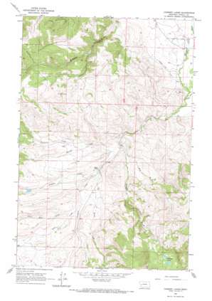
Chimney Lakes Topo Map Montana
To zoom in, hover over the map of Chimney Lakes
USGS Topo Quad 46113g1 - 1:24,000 scale
| Topo Map Name: | Chimney Lakes |
| USGS Topo Quad ID: | 46113g1 |
| Print Size: | ca. 21 1/4" wide x 27" high |
| Southeast Coordinates: | 46.75° N latitude / 113° W longitude |
| Map Center Coordinates: | 46.8125° N latitude / 113.0625° W longitude |
| U.S. State: | MT |
| Filename: | o46113g1.jpg |
| Download Map JPG Image: | Chimney Lakes topo map 1:24,000 scale |
| Map Type: | Topographic |
| Topo Series: | 7.5´ |
| Map Scale: | 1:24,000 |
| Source of Map Images: | United States Geological Survey (USGS) |
| Alternate Map Versions: |
Chimney Lakes MT 1965, updated 1967 Download PDF Buy paper map Chimney Lakes MT 2011 Download PDF Buy paper map Chimney Lakes MT 2014 Download PDF Buy paper map |
1:24,000 Topo Quads surrounding Chimney Lakes
> Back to 46113e1 at 1:100,000 scale
> Back to 46112a1 at 1:250,000 scale
> Back to U.S. Topo Maps home
Chimney Lakes topo map: Gazetteer
Chimney Lakes: Canals
Number Five Ditch elevation 1345m 4412′Chimney Lakes: Dams
Manley Number 2 Dam elevation 1448m 4750′Manley Number 3 Dam elevation 1432m 4698′
Chimney Lakes: Lakes
Chimney Lakes elevation 1626m 5334′Chimney Lakes: Springs
12N12W11BBDC01 Spring elevation 1429m 4688′Chimney Lakes: Streams
Bear Creek elevation 1410m 4625′Black Bear Creek elevation 1415m 4642′
Chimney Creek elevation 1377m 4517′
Fivemile Creek elevation 1401m 4596′
Mud Creek elevation 1394m 4573′
Murray Creek elevation 1382m 4534′
Sheep Creek elevation 1402m 4599′
Sturgeon Creek elevation 1392m 4566′
Chimney Lakes: Wells
13N11W20DDAA01 Well elevation 1316m 4317′13N11W29DCA_01 Well elevation 1348m 4422′
Chimney Lakes digital topo map on disk
Buy this Chimney Lakes topo map showing relief, roads, GPS coordinates and other geographical features, as a high-resolution digital map file on DVD:


