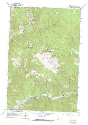
Blue Point Topo Map Montana
To zoom in, hover over the map of Blue Point
USGS Topo Quad 46113h7 - 1:24,000 scale
| Topo Map Name: | Blue Point |
| USGS Topo Quad ID: | 46113h7 |
| Print Size: | ca. 21 1/4" wide x 27" high |
| Southeast Coordinates: | 46.875° N latitude / 113.75° W longitude |
| Map Center Coordinates: | 46.9375° N latitude / 113.8125° W longitude |
| U.S. State: | MT |
| Filename: | o46113h7.jpg |
| Download Map JPG Image: | Blue Point topo map 1:24,000 scale |
| Map Type: | Topographic |
| Topo Series: | 7.5´ |
| Map Scale: | 1:24,000 |
| Source of Map Images: | United States Geological Survey (USGS) |
| Alternate Map Versions: |
Blue Point MT 1965, updated 1967 Download PDF Buy paper map Blue Point MT 1965, updated 1990 Download PDF Buy paper map Blue Point MT 1999, updated 2003 Download PDF Buy paper map Blue Point MT 2011 Download PDF Buy paper map Blue Point MT 2014 Download PDF Buy paper map |
| FStopo: | US Forest Service topo Blue Point is available: Download FStopo PDF Download FStopo TIF |
1:24,000 Topo Quads surrounding Blue Point
> Back to 46113e1 at 1:100,000 scale
> Back to 46112a1 at 1:250,000 scale
> Back to U.S. Topo Maps home
Blue Point topo map: Gazetteer
Blue Point: Bridges
Marco Flat Bridge elevation 996m 3267′Wisherd Bridge elevation 1021m 3349′
Blue Point: Cliffs
Blue Slide elevation 1185m 3887′Blue Point: Parks
Angevine Park Picnic Area elevation 1028m 3372′Big Blackfoot Railway Historical Marker elevation 1029m 3375′
Marco Flat Picnic Area elevation 1020m 3346′
Blue Point: Populated Places
Miller elevation 1025m 3362′Blue Point: Ridges
Wisherd Ridge elevation 2173m 7129′Blue Point: Streams
Beeskove Creek elevation 1223m 4012′East Fork Rattlesnake Creek elevation 1265m 4150′
La Fray Creek elevation 1011m 3316′
Saint Lawrence Creek elevation 1035m 3395′
Tamarack Creek elevation 1024m 3359′
Blue Point: Summits
Blue Point elevation 2072m 6797′Lockwood Point elevation 2031m 6663′
Sheep Mountain elevation 2332m 7650′
Blue Point: Swamps
Shoofly Meadows elevation 1788m 5866′Blue Point: Valleys
Johnson Gulch elevation 1002m 3287′Wisherd Gulch elevation 1035m 3395′
Blue Point digital topo map on disk
Buy this Blue Point topo map showing relief, roads, GPS coordinates and other geographical features, as a high-resolution digital map file on DVD:


