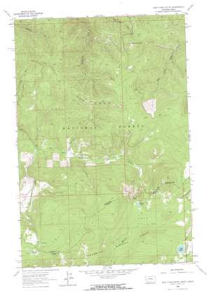
West Fork Butte Topo Map Montana
To zoom in, hover over the map of West Fork Butte
USGS Topo Quad 46114f4 - 1:24,000 scale
| Topo Map Name: | West Fork Butte |
| USGS Topo Quad ID: | 46114f4 |
| Print Size: | ca. 21 1/4" wide x 27" high |
| Southeast Coordinates: | 46.625° N latitude / 114.375° W longitude |
| Map Center Coordinates: | 46.6875° N latitude / 114.4375° W longitude |
| U.S. States: | MT, ID |
| Filename: | o46114f4.jpg |
| Download Map JPG Image: | West Fork Butte topo map 1:24,000 scale |
| Map Type: | Topographic |
| Topo Series: | 7.5´ |
| Map Scale: | 1:24,000 |
| Source of Map Images: | United States Geological Survey (USGS) |
| Alternate Map Versions: |
West Fork Butte MT 1964, updated 1967 Download PDF Buy paper map West Fork Butte MT 1964, updated 1967 Download PDF Buy paper map West Fork Butte MT 1999, updated 2003 Download PDF Buy paper map West Fork Butte MT 2011 Download PDF Buy paper map West Fork Butte MT 2014 Download PDF Buy paper map |
| FStopo: | US Forest Service topo West Fork Butte is available: Download FStopo PDF Download FStopo TIF |
1:24,000 Topo Quads surrounding West Fork Butte
> Back to 46114e1 at 1:100,000 scale
> Back to 46114a1 at 1:250,000 scale
> Back to U.S. Topo Maps home
West Fork Butte topo map: Gazetteer
West Fork Butte: Flats
Lost Park elevation 1806m 5925′Lost Park Meadows elevation 1817m 5961′
West Fork Butte: Lakes
Granite Lake elevation 1802m 5912′Lily Lake elevation 1945m 6381′
West Fork Butte: Ridges
Sally Ridge elevation 1806m 5925′West Fork Butte: Streams
Lost Park Creek elevation 1380m 4527′West Fork Butte: Summits
Skookum Butte elevation 2205m 7234′Skookum Butte elevation 2205m 7234′
West Fork Butte elevation 1873m 6145′
West Fork Butte: Trails
Sally Ridge Trail elevation 2026m 6646′West Fork Butte digital topo map on disk
Buy this West Fork Butte topo map showing relief, roads, GPS coordinates and other geographical features, as a high-resolution digital map file on DVD:


