Bruin Hill Topo Map Idaho
To zoom in, hover over the map of Bruin Hill
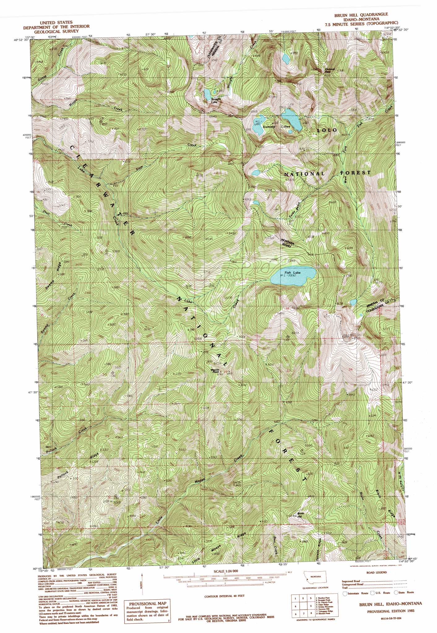
USGS Topo Quad 46114g8 - 1:24,000 scale
| Topo Map Name: | Bruin Hill |
| USGS Topo Quad ID: | 46114g8 |
| Print Size: | ca. 21 1/4" wide x 27" high |
| Southeast Coordinates: | 46.75° N latitude / 114.875° W longitude |
| Map Center Coordinates: | 46.8125° N latitude / 114.9375° W longitude |
| U.S. States: | ID, MT |
| Filename: | o46114g8.jpg |
| Download Map JPG Image: | Bruin Hill topo map 1:24,000 scale |
| Map Type: | Topographic |
| Topo Series: | 7.5´ |
| Map Scale: | 1:24,000 |
| Source of Map Images: | United States Geological Survey (USGS) |
| Alternate Map Versions: |
Bruin Hill ID 1985, updated 1985 Download PDF Buy paper map Bruin Hill ID 1994, updated 1997 Download PDF Buy paper map Bruin Hill ID 2011 Download PDF Buy paper map Bruin Hill ID 2013 Download PDF Buy paper map |
| FStopo: | US Forest Service topo Bruin Hill is available: Download FStopo PDF Download FStopo TIF |
1:24,000 Topo Quads surrounding Bruin Hill
Sherlock Peak |
Illinois Peak |
Landowner Mountain |
Lozeau |
Tarkio |
Chamberlain Mountain |
Hoodoo Pass |
Straight Peak |
Saint Patrick Peak |
Williams Peak |
Moose Mountain |
Osier Ridge |
Bruin Hill |
Schley Mountain |
White Mountain |
Scurvy Mountain |
Gorman Hill |
Toboggan Ridge |
Rhodes Peak |
Granite Pass |
Lookout Peak |
Horseshoe Lake |
Indian Postoffice |
Cayuse Junction |
Rocky Point |
> Back to 46114e1 at 1:100,000 scale
> Back to 46114a1 at 1:250,000 scale
> Back to U.S. Topo Maps home
Bruin Hill topo map: Gazetteer
Bruin Hill: Basins
Foley Basin elevation 1714m 5623′Bruin Hill: Gaps
Chilcoot Pass elevation 2064m 6771′Bruin Hill: Lakes
Fish Lake elevation 1797m 5895′Siamese Lakes elevation 1824m 5984′
Straight Lake elevation 1949m 6394′
Bruin Hill: Ridges
Bruin Ridge elevation 1736m 5695′Bruin Hill: Streams
Japanese Creek elevation 1459m 4786′Siam Creek elevation 1414m 4639′
Wapito Creek elevation 1473m 4832′
Bruin Hill: Summits
Bruin Hill elevation 1982m 6502′Wapito Point elevation 1930m 6332′
Bruin Hill digital topo map on disk
Buy this Bruin Hill topo map showing relief, roads, GPS coordinates and other geographical features, as a high-resolution digital map file on DVD: