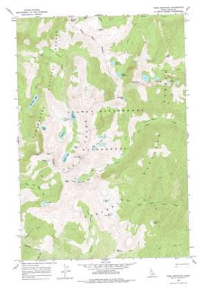
Fenn Mountain Topo Map Idaho
To zoom in, hover over the map of Fenn Mountain
USGS Topo Quad 46115b2 - 1:24,000 scale
| Topo Map Name: | Fenn Mountain |
| USGS Topo Quad ID: | 46115b2 |
| Print Size: | ca. 21 1/4" wide x 27" high |
| Southeast Coordinates: | 46.125° N latitude / 115.125° W longitude |
| Map Center Coordinates: | 46.1875° N latitude / 115.1875° W longitude |
| U.S. State: | ID |
| Filename: | o46115b2.jpg |
| Download Map JPG Image: | Fenn Mountain topo map 1:24,000 scale |
| Map Type: | Topographic |
| Topo Series: | 7.5´ |
| Map Scale: | 1:24,000 |
| Source of Map Images: | United States Geological Survey (USGS) |
| Alternate Map Versions: |
Fenn Mountain ID 1966, updated 1968 Download PDF Buy paper map Fenn Mountain ID 1966, updated 1978 Download PDF Buy paper map Fenn Mountain ID 1995, updated 1999 Download PDF Buy paper map Fenn Mountain ID 2011 Download PDF Buy paper map Fenn Mountain ID 2013 Download PDF Buy paper map |
| FStopo: | US Forest Service topo Fenn Mountain is available: Download FStopo PDF Download FStopo TIF |
1:24,000 Topo Quads surrounding Fenn Mountain
> Back to 46115a1 at 1:100,000 scale
> Back to 46114a1 at 1:250,000 scale
> Back to U.S. Topo Maps home
Fenn Mountain topo map: Gazetteer
Fenn Mountain: Flats
Canteen Meadows elevation 1849m 6066′Old Man Meadows elevation 1479m 4852′
Three Links Meadows elevation 1498m 4914′
Fenn Mountain: Gaps
Jesse Pass elevation 2202m 7224′Fenn Mountain: Lakes
Big Fog Lake elevation 1935m 6348′Cove Lakes elevation 1925m 6315′
Crystal Lake elevation 1888m 6194′
Dishpan Lake elevation 1873m 6145′
East Peak Lake elevation 1938m 6358′
Elizabeth Lake elevation 1790m 5872′
Florence Lake elevation 1918m 6292′
Hjort Lake elevation 1908m 6259′
Kettle Lake elevation 2181m 7155′
Legend Lake elevation 2070m 6791′
Lizard Lakes elevation 1948m 6391′
Lloyd Lake elevation 1893m 6210′
Lone Lakes elevation 2003m 6571′
North Lone Lake elevation 1946m 6384′
North Three Links Lakes elevation 2071m 6794′
Old Man Lake elevation 1693m 5554′
Parsons Lake elevation 1766m 5793′
Rainbow Lake elevation 2142m 7027′
South Lone Lake elevation 1981m 6499′
South Three Links Lakes elevation 1890m 6200′
Fenn Mountain: Streams
Lone Creek elevation 1573m 5160′Fenn Mountain: Summits
Big Fog Mountain elevation 2175m 7135′East Peak elevation 2391m 7844′
Fenn Mountain elevation 2436m 7992′
Lizard Peak elevation 2162m 7093′
Stanley Butte elevation 2238m 7342′
The Crags elevation 2243m 7358′
Fenn Mountain digital topo map on disk
Buy this Fenn Mountain topo map showing relief, roads, GPS coordinates and other geographical features, as a high-resolution digital map file on DVD:


