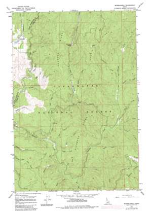
Musselshell Topo Map Idaho
To zoom in, hover over the map of Musselshell
USGS Topo Quad 46115c6 - 1:24,000 scale
| Topo Map Name: | Musselshell |
| USGS Topo Quad ID: | 46115c6 |
| Print Size: | ca. 21 1/4" wide x 27" high |
| Southeast Coordinates: | 46.25° N latitude / 115.625° W longitude |
| Map Center Coordinates: | 46.3125° N latitude / 115.6875° W longitude |
| U.S. State: | ID |
| Filename: | o46115c6.jpg |
| Download Map JPG Image: | Musselshell topo map 1:24,000 scale |
| Map Type: | Topographic |
| Topo Series: | 7.5´ |
| Map Scale: | 1:24,000 |
| Source of Map Images: | United States Geological Survey (USGS) |
| Alternate Map Versions: |
Musselshell ID 1966, updated 1968 Download PDF Buy paper map Musselshell ID 1966, updated 1984 Download PDF Buy paper map Musselshell ID 1994, updated 1998 Download PDF Buy paper map Musselshell ID 2011 Download PDF Buy paper map Musselshell ID 2013 Download PDF Buy paper map |
| FStopo: | US Forest Service topo Musselshell is available: Download FStopo PDF Download FStopo TIF |
1:24,000 Topo Quads surrounding Musselshell
> Back to 46115a1 at 1:100,000 scale
> Back to 46114a1 at 1:250,000 scale
> Back to U.S. Topo Maps home
Musselshell topo map: Gazetteer
Musselshell: Flats
Musselshell Meadows elevation 971m 3185′Musselshell: Gaps
Chamook Saddle elevation 1216m 3989′Musselshell: Populated Places
Clark Tree elevation 987m 3238′Musselshell elevation 976m 3202′
Musselshell: Ridges
Austin Ridge elevation 1428m 4685′Chamook Ridge elevation 1300m 4265′
Eldorado Ridge elevation 1137m 3730′
Musselshell: Streams
April Creek elevation 987m 3238′Austin Creek elevation 1098m 3602′
Brick Creek elevation 988m 3241′
Cedar Creek elevation 941m 3087′
Dollar Creek elevation 1089m 3572′
Dora Creek elevation 957m 3139′
Eva Creek elevation 960m 3149′
Fan Creek elevation 997m 3270′
Gold Creek elevation 989m 3244′
Kate Creek elevation 983m 3225′
Linda Creek elevation 963m 3159′
Lunch Creek elevation 1079m 3540′
May Creek elevation 1038m 3405′
Mike White Creek elevation 948m 3110′
Nevada Creek elevation 938m 3077′
Opal Creek elevation 954m 3129′
Panther Creek elevation 987m 3238′
Six-Bit Creek elevation 1097m 3599′
Snow Creek elevation 986m 3234′
Trout Creek elevation 1016m 3333′
Two-bit Creek elevation 1089m 3572′
Utah Creek elevation 947m 3106′
Wapiti Creek elevation 1059m 3474′
White Creek elevation 964m 3162′
Musselshell: Woods
Lewis and Clark Grove elevation 986m 3234′Musselshell digital topo map on disk
Buy this Musselshell topo map showing relief, roads, GPS coordinates and other geographical features, as a high-resolution digital map file on DVD:


