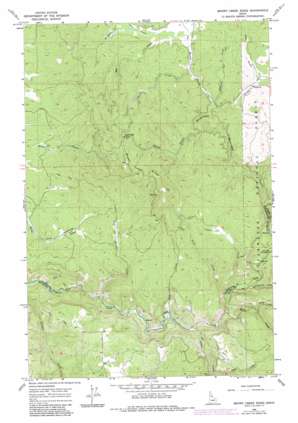
Brown Creek Ridge Topo Map Idaho
To zoom in, hover over the map of Brown Creek Ridge
USGS Topo Quad 46115c7 - 1:24,000 scale
| Topo Map Name: | Brown Creek Ridge |
| USGS Topo Quad ID: | 46115c7 |
| Print Size: | ca. 21 1/4" wide x 27" high |
| Southeast Coordinates: | 46.25° N latitude / 115.75° W longitude |
| Map Center Coordinates: | 46.3125° N latitude / 115.8125° W longitude |
| U.S. State: | ID |
| Filename: | o46115c7.jpg |
| Download Map JPG Image: | Brown Creek Ridge topo map 1:24,000 scale |
| Map Type: | Topographic |
| Topo Series: | 7.5´ |
| Map Scale: | 1:24,000 |
| Source of Map Images: | United States Geological Survey (USGS) |
| Alternate Map Versions: |
Brown Creek Ridge ID 1966, updated 1968 Download PDF Buy paper map Brown Creek Ridge ID 1966, updated 1984 Download PDF Buy paper map Brown Creek Ridge ID 1994, updated 1997 Download PDF Buy paper map Brown Creek Ridge ID 2011 Download PDF Buy paper map Brown Creek Ridge ID 2014 Download PDF Buy paper map |
| FStopo: | US Forest Service topo Brown Creek Ridge is available: Download FStopo PDF Download FStopo TIF |
1:24,000 Topo Quads surrounding Brown Creek Ridge
> Back to 46115a1 at 1:100,000 scale
> Back to 46114a1 at 1:250,000 scale
> Back to U.S. Topo Maps home
Brown Creek Ridge topo map: Gazetteer
Brown Creek Ridge: Ridges
Brown Creek Ridge elevation 1203m 3946′Brown Creek Ridge: Streams
Blonde Creek elevation 951m 3120′Brady Creek elevation 928m 3044′
Brunt Creek elevation 952m 3123′
Buckner Creek elevation 852m 2795′
Burnt Creek elevation 952m 3123′
Crane Creek elevation 842m 2762′
Eldorado Creek elevation 873m 2864′
Jim Brown Creek elevation 948m 3110′
Mosquito Creek elevation 961m 3152′
Mud Creek elevation 836m 2742′
Musselshell Creek elevation 912m 2992′
North Fork Mud Creek elevation 913m 2995′
Pete and Charlie Creek elevation 767m 2516′
Rock Creek elevation 817m 2680′
Slate Creek elevation 950m 3116′
Trout Creek elevation 837m 2746′
Yakus Creek elevation 814m 2670′
Brown Creek Ridge: Valleys
Deer Gulch elevation 974m 3195′Brown Creek Ridge digital topo map on disk
Buy this Brown Creek Ridge topo map showing relief, roads, GPS coordinates and other geographical features, as a high-resolution digital map file on DVD:


