Holly Creek Topo Map Idaho
To zoom in, hover over the map of Holly Creek
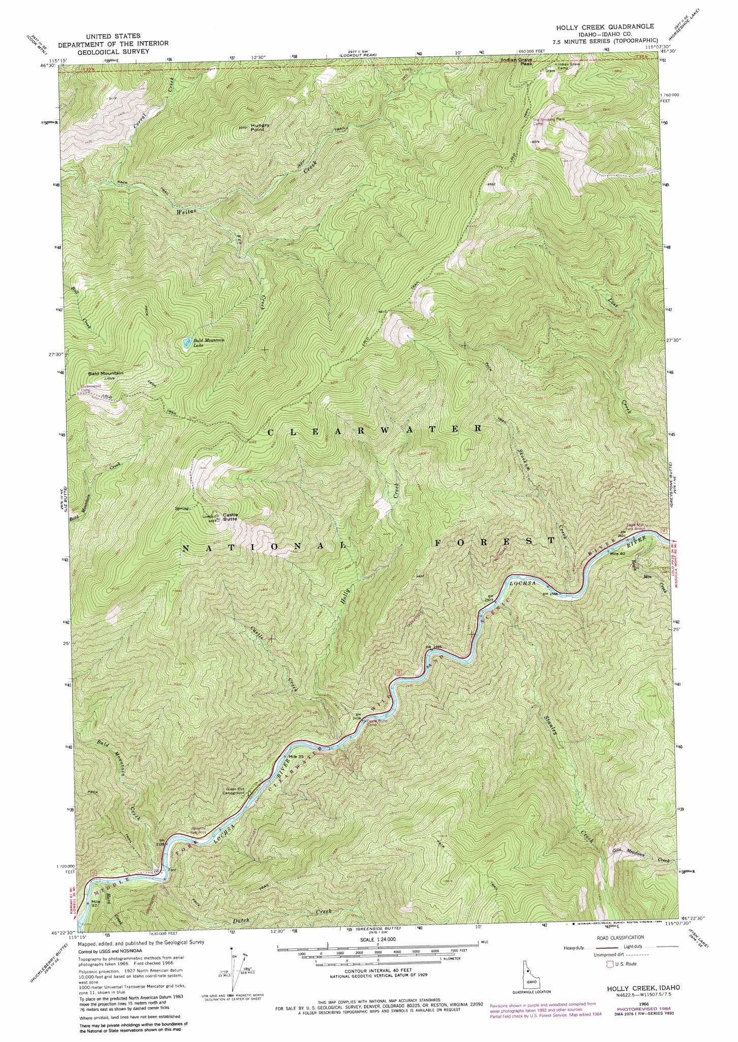
USGS Topo Quad 46115d2 - 1:24,000 scale
| Topo Map Name: | Holly Creek |
| USGS Topo Quad ID: | 46115d2 |
| Print Size: | ca. 21 1/4" wide x 27" high |
| Southeast Coordinates: | 46.375° N latitude / 115.125° W longitude |
| Map Center Coordinates: | 46.4375° N latitude / 115.1875° W longitude |
| U.S. State: | ID |
| Filename: | o46115d2.jpg |
| Download Map JPG Image: | Holly Creek topo map 1:24,000 scale |
| Map Type: | Topographic |
| Topo Series: | 7.5´ |
| Map Scale: | 1:24,000 |
| Source of Map Images: | United States Geological Survey (USGS) |
| Alternate Map Versions: |
Holly Creek ID 1966, updated 1969 Download PDF Buy paper map Holly Creek ID 1966, updated 1984 Download PDF Buy paper map Holly Creek ID 1994, updated 1997 Download PDF Buy paper map Holly Creek ID 2005, updated 2005 Download PDF Buy paper map Holly Creek ID 2011 Download PDF Buy paper map Holly Creek ID 2013 Download PDF Buy paper map |
| FStopo: | US Forest Service topo Holly Creek is available: Download FStopo PDF Download FStopo TIF |
1:24,000 Topo Quads surrounding Holly Creek
Pot Mountain |
Junction Mountain |
Scurvy Mountain |
Gorman Hill |
Toboggan Ridge |
Lean-To Point |
Cook Mountain |
Lookout Peak |
Horseshoe Lake |
Indian Postoffice |
Weitas Butte |
Liz Butte |
Holly Creek |
Greystone Butte |
Bear Mountain |
Mclendon Butte |
Huckleberry Butte |
Greenside Butte |
Fish Lake |
Mcconnell Mountain |
Coolwater Mountain |
Chimney Peak |
Fenn Mountain |
Big Rock Mountain |
Shissler Peak |
> Back to 46115a1 at 1:100,000 scale
> Back to 46114a1 at 1:250,000 scale
> Back to U.S. Topo Maps home
Holly Creek topo map: Gazetteer
Holly Creek: Bridges
Eagle Mountain Pack Bridge elevation 795m 2608′Holly Creek: Lakes
Bald Mountain Lake elevation 1752m 5748′Holly Creek: Streams
Bald Mountain Creek elevation 706m 2316′Castle Creek elevation 739m 2424′
Corral Creek elevation 1190m 3904′
Dutch Creek elevation 704m 2309′
Eagle Mountain Creek elevation 804m 2637′
Fro Creek elevation 1260m 4133′
Gold Meadows Creek elevation 1371m 4498′
Hard Creek elevation 690m 2263′
Holly Creek elevation 742m 2434′
Skookum Creek elevation 788m 2585′
Stanley Creek elevation 773m 2536′
Holly Creek: Summits
Bald Mountain elevation 1992m 6535′Castle Butte elevation 2029m 6656′
Hungry Point elevation 1753m 5751′
Holly Creek digital topo map on disk
Buy this Holly Creek topo map showing relief, roads, GPS coordinates and other geographical features, as a high-resolution digital map file on DVD: