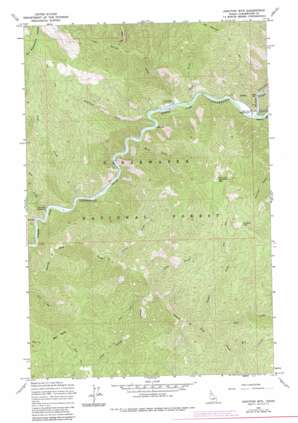
Junction Mountain Topo Map Idaho
To zoom in, hover over the map of Junction Mountain
USGS Topo Quad 46115f3 - 1:24,000 scale
| Topo Map Name: | Junction Mountain |
| USGS Topo Quad ID: | 46115f3 |
| Print Size: | ca. 21 1/4" wide x 27" high |
| Southeast Coordinates: | 46.625° N latitude / 115.25° W longitude |
| Map Center Coordinates: | 46.6875° N latitude / 115.3125° W longitude |
| U.S. State: | ID |
| Filename: | o46115f3.jpg |
| Download Map JPG Image: | Junction Mountain topo map 1:24,000 scale |
| Map Type: | Topographic |
| Topo Series: | 7.5´ |
| Map Scale: | 1:24,000 |
| Source of Map Images: | United States Geological Survey (USGS) |
| Alternate Map Versions: |
Junction Mtn ID 1965, updated 1967 Download PDF Buy paper map Junction Mountain ID 1994, updated 1997 Download PDF Buy paper map Junction Mountain ID 2011 Download PDF Buy paper map Junction Mountain ID 2014 Download PDF Buy paper map |
| FStopo: | US Forest Service topo Junction Mountain is available: Download FStopo PDF Download FStopo TIF |
1:24,000 Topo Quads surrounding Junction Mountain
> Back to 46115e1 at 1:100,000 scale
> Back to 46114a1 at 1:250,000 scale
> Back to U.S. Topo Maps home
Junction Mountain topo map: Gazetteer
Junction Mountain: Streams
Adams Creek elevation 921m 3021′Bacon Creek elevation 803m 2634′
Bill Creek elevation 1120m 3674′
Camp George Creek elevation 960m 3149′
Canyon Creek elevation 1027m 3369′
Coffee Creek elevation 950m 3116′
Cold Springs Creek elevation 821m 2693′
Cool Creek elevation 1058m 3471′
Gilfillian Creek elevation 828m 2716′
High Creek elevation 830m 2723′
Ice Creek elevation 936m 3070′
Kelly Creek elevation 839m 2752′
Noe Creek elevation 767m 2516′
Shot Creek elevation 1048m 3438′
Trail Creek elevation 779m 2555′
Junction Mountain: Summits
Flat Mountain elevation 2014m 6607′Junction Mountain: Valleys
Black Canyon elevation 842m 2762′Junction Mountain digital topo map on disk
Buy this Junction Mountain topo map showing relief, roads, GPS coordinates and other geographical features, as a high-resolution digital map file on DVD:


