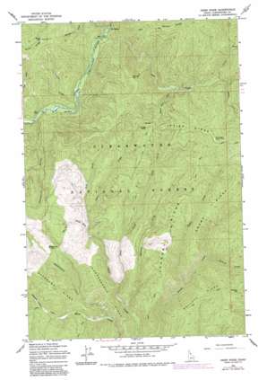
Osier Ridge Topo Map Idaho
To zoom in, hover over the map of Osier Ridge
USGS Topo Quad 46115g1 - 1:24,000 scale
| Topo Map Name: | Osier Ridge |
| USGS Topo Quad ID: | 46115g1 |
| Print Size: | ca. 21 1/4" wide x 27" high |
| Southeast Coordinates: | 46.75° N latitude / 115° W longitude |
| Map Center Coordinates: | 46.8125° N latitude / 115.0625° W longitude |
| U.S. State: | ID |
| Filename: | o46115g1.jpg |
| Download Map JPG Image: | Osier Ridge topo map 1:24,000 scale |
| Map Type: | Topographic |
| Topo Series: | 7.5´ |
| Map Scale: | 1:24,000 |
| Source of Map Images: | United States Geological Survey (USGS) |
| Alternate Map Versions: |
Osier Ridge ID 1965, updated 1967 Download PDF Buy paper map Osier Ridge ID 1965, updated 1984 Download PDF Buy paper map Osier Ridge ID 1994, updated 1997 Download PDF Buy paper map Osier Ridge ID 2011 Download PDF Buy paper map Osier Ridge ID 2013 Download PDF Buy paper map |
| FStopo: | US Forest Service topo Osier Ridge is available: Download FStopo PDF Download FStopo TIF |
1:24,000 Topo Quads surrounding Osier Ridge
> Back to 46115e1 at 1:100,000 scale
> Back to 46114a1 at 1:250,000 scale
> Back to U.S. Topo Maps home
Osier Ridge topo map: Gazetteer
Osier Ridge: Populated Places
Moose City elevation 1257m 4124′The Cedars elevation 1122m 3681′
Osier Ridge: Ridges
Independence Ridge elevation 1376m 4514′Laundry Ridge elevation 1474m 4835′
Osier Ridge elevation 1842m 6043′
Pollock Ridge elevation 1651m 5416′
Swamp Ridge elevation 1537m 5042′
Osier Ridge: Streams
Broken Nose Creek elevation 1216m 3989′China Creek elevation 1129m 3704′
Coyote Creek elevation 1092m 3582′
Deadwood Creek elevation 1145m 3756′
Goose Creek elevation 1304m 4278′
Independence Creek elevation 1060m 3477′
Lake Creek elevation 1124m 3687′
Laundry Creek elevation 1081m 3546′
Long Creek elevation 1129m 3704′
Moses Creek elevation 1337m 4386′
Pollock Creek elevation 1196m 3923′
Shell Creek elevation 1301m 4268′
Sugar Creek elevation 1141m 3743′
West Fork Osier Creek elevation 1276m 4186′
Osier Ridge: Summits
Birch Hill elevation 1685m 5528′Jungle Point elevation 1566m 5137′
Pollock Hill elevation 1666m 5465′
Spring Hill elevation 1639m 5377′
Osier Ridge: Valleys
Deception Gulch elevation 1064m 3490′Pioneer Gulch elevation 1233m 4045′
Sailor Gulch elevation 1282m 4206′
Osier Ridge digital topo map on disk
Buy this Osier Ridge topo map showing relief, roads, GPS coordinates and other geographical features, as a high-resolution digital map file on DVD:


