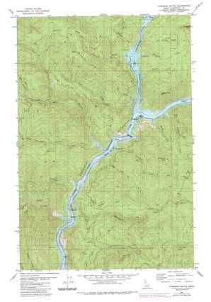
Township Butte Topo Map Idaho
To zoom in, hover over the map of Township Butte
USGS Topo Quad 46115g8 - 1:24,000 scale
| Topo Map Name: | Township Butte |
| USGS Topo Quad ID: | 46115g8 |
| Print Size: | ca. 21 1/4" wide x 27" high |
| Southeast Coordinates: | 46.75° N latitude / 115.875° W longitude |
| Map Center Coordinates: | 46.8125° N latitude / 115.9375° W longitude |
| U.S. State: | ID |
| Filename: | o46115g8.jpg |
| Download Map JPG Image: | Township Butte topo map 1:24,000 scale |
| Map Type: | Topographic |
| Topo Series: | 7.5´ |
| Map Scale: | 1:24,000 |
| Source of Map Images: | United States Geological Survey (USGS) |
| Alternate Map Versions: |
Township Butte ID 1981, updated 1982 Download PDF Buy paper map Township Butte ID 1981, updated 1984 Download PDF Buy paper map Township Butte ID 1994, updated 1997 Download PDF Buy paper map Township Butte ID 2011 Download PDF Buy paper map Township Butte ID 2013 Download PDF Buy paper map |
| FStopo: | US Forest Service topo Township Butte is available: Download FStopo PDF Download FStopo TIF |
1:24,000 Topo Quads surrounding Township Butte
> Back to 46115e1 at 1:100,000 scale
> Back to 46114a1 at 1:250,000 scale
> Back to U.S. Topo Maps home
Township Butte topo map: Gazetteer
Township Butte: Populated Places
Boehls elevation 489m 1604′Township Butte: Streams
Breakfast Creek elevation 489m 1604′Elkberry Creek elevation 489m 1604′
Elmberry Creek elevation 489m 1604′
Gold Creek elevation 489m 1604′
Grandad Creek elevation 489m 1604′
Gyppo Creek elevation 489m 1604′
Little Meadow Creek elevation 489m 1604′
Little North Fork Clearwater River elevation 489m 1604′
Long Creek elevation 489m 1604′
McIntyre Creek elevation 489m 1604′
Middle Fork Robinson Creek elevation 681m 2234′
North Fork Robinson Creek elevation 681m 2234′
Robinson Creek elevation 489m 1604′
Silver Creek elevation 489m 1604′
South Fork Robinson Creek elevation 489m 1604′
Telephone Creek elevation 489m 1604′
Township Butte: Summits
Township Butte elevation 1468m 4816′Township Butte: Trails
Rukgaber Trail elevation 1037m 3402′Township Butte digital topo map on disk
Buy this Township Butte topo map showing relief, roads, GPS coordinates and other geographical features, as a high-resolution digital map file on DVD:


