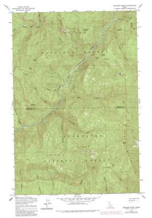
Buzzard Roost Topo Map Idaho
To zoom in, hover over the map of Buzzard Roost
USGS Topo Quad 46115h6 - 1:24,000 scale
| Topo Map Name: | Buzzard Roost |
| USGS Topo Quad ID: | 46115h6 |
| Print Size: | ca. 21 1/4" wide x 27" high |
| Southeast Coordinates: | 46.875° N latitude / 115.625° W longitude |
| Map Center Coordinates: | 46.9375° N latitude / 115.6875° W longitude |
| U.S. State: | ID |
| Filename: | o46115h6.jpg |
| Download Map JPG Image: | Buzzard Roost topo map 1:24,000 scale |
| Map Type: | Topographic |
| Topo Series: | 7.5´ |
| Map Scale: | 1:24,000 |
| Source of Map Images: | United States Geological Survey (USGS) |
| Alternate Map Versions: |
Buzzard Roost ID 1963, updated 1964 Download PDF Buy paper map Buzzard Roost ID 1963, updated 1984 Download PDF Buy paper map Buzzard Roost ID 1994, updated 1997 Download PDF Buy paper map Buzzard Roost ID 2011 Download PDF Buy paper map Buzzard Roost ID 2013 Download PDF Buy paper map |
| FStopo: | US Forest Service topo Buzzard Roost is available: Download FStopo PDF Download FStopo TIF |
1:24,000 Topo Quads surrounding Buzzard Roost
> Back to 46115e1 at 1:100,000 scale
> Back to 46114a1 at 1:250,000 scale
> Back to U.S. Topo Maps home
Buzzard Roost topo map: Gazetteer
Buzzard Roost: Lakes
Devils Lake elevation 1567m 5141′Buzzard Roost: Ridges
Salmon Ridge elevation 1281m 4202′Buzzard Roost: Streams
Bear Creek elevation 727m 2385′Brush Creek elevation 927m 3041′
Buzzard Creek elevation 830m 2723′
Calipeen Creek elevation 754m 2473′
Cobbler Creek elevation 890m 2919′
Crescendo Creek elevation 695m 2280′
Delate Creek elevation 748m 2454′
Devils Club Creek elevation 784m 2572′
Dip Creek elevation 964m 3162′
Foehl Creek elevation 774m 2539′
Honey Creek elevation 867m 2844′
Larkins Creek elevation 769m 2522′
Minnesaka Creek elevation 727m 2385′
Mulligan Creek elevation 841m 2759′
Pitchfork Creek elevation 995m 3264′
Sawtooth Creek elevation 789m 2588′
Buzzard Roost: Summits
Buzzard Roost elevation 1445m 4740′Devils Pulpit elevation 1191m 3907′
Getaway Point elevation 1472m 4829′
Grassy Point elevation 1899m 6230′
Indian Dip elevation 1706m 5597′
Joker Peak elevation 1711m 5613′
Mulligan Hump elevation 1173m 3848′
Buzzard Roost digital topo map on disk
Buy this Buzzard Roost topo map showing relief, roads, GPS coordinates and other geographical features, as a high-resolution digital map file on DVD:


