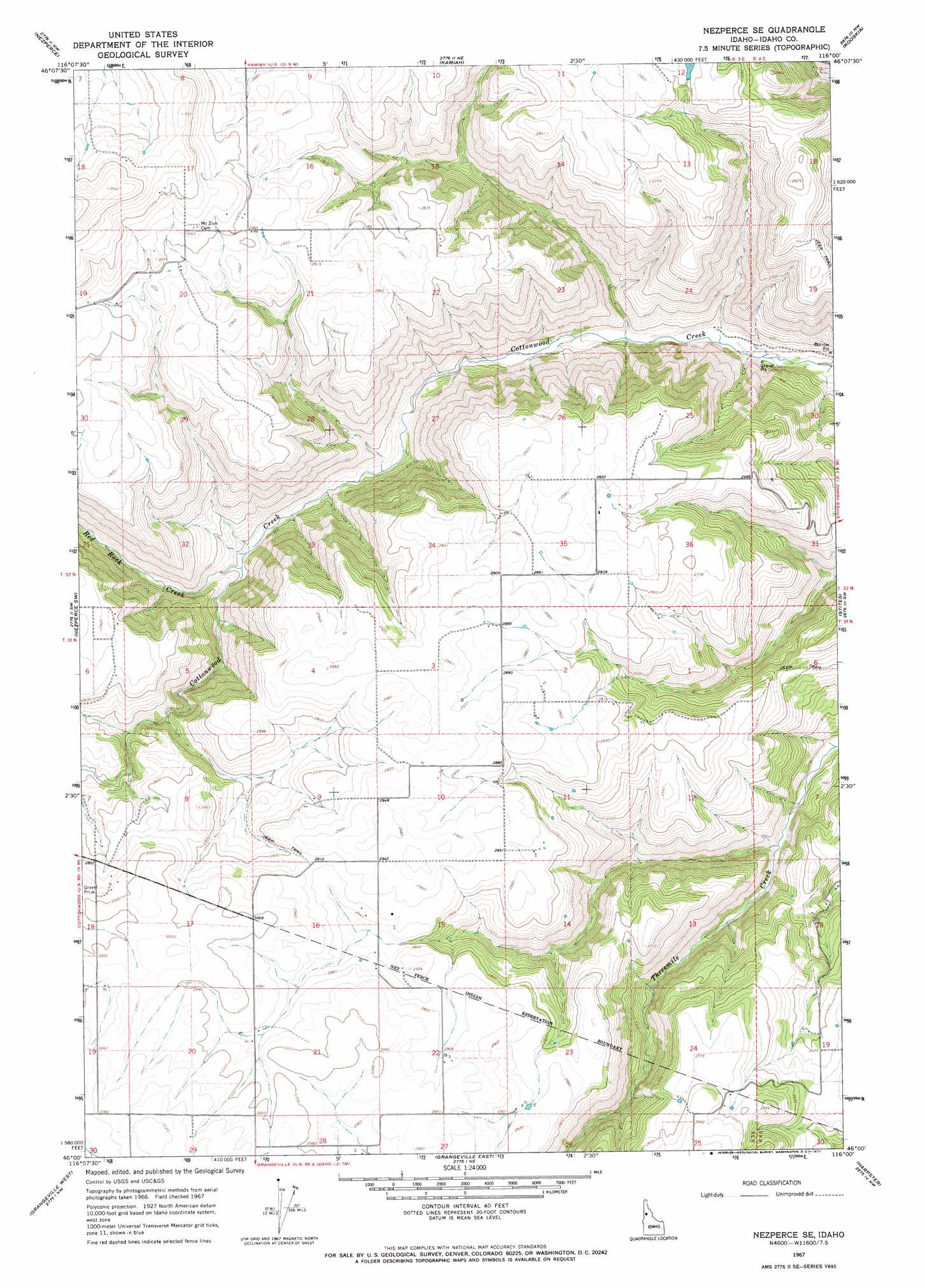
Nezperce Se Topo Map Idaho
To zoom in, hover over the map of Nezperce Se
USGS Topo Quad 46116a1 - 1:24,000 scale
| Topo Map Name: | Nezperce Se |
| USGS Topo Quad ID: | 46116a1 |
| Print Size: | ca. 21 1/4" wide x 27" high |
| Southeast Coordinates: | 46° N latitude / 116° W longitude |
| Map Center Coordinates: | 46.0625° N latitude / 116.0625° W longitude |
| U.S. State: | ID |
| Filename: | o46116a1.jpg |
| Download Map JPG Image: | Nezperce Se topo map 1:24,000 scale |
| Map Type: | Topographic |
| Topo Series: | 7.5´ |
| Map Scale: | 1:24,000 |
| Source of Map Images: | United States Geological Survey (USGS) |
| Alternate Map Versions: |
Nezperce SE ID 1967, updated 1970 Download PDF Buy paper map Nezperce SE ID 1967, updated 1971 Download PDF Buy paper map Nezperce SE ID 2010 Download PDF Buy paper map Nezperce SE ID 2013 Download PDF Buy paper map |
1:24,000 Topo Quads surrounding Nezperce Se
Mohler |
Sixmile Creek |
Woodland |
Weippe South |
Brown Creek Ridge |
Cottonwood Ne |
Nezperce |
Kamiah |
Kooskia |
Glenwood |
Cottonwood |
Nezperce Sw |
Nezperce Se |
Stites |
Big Cedar |
Fenn |
Grangeville West |
Grangeville East |
Harpster |
Corral Hill |
White Bird |
White Bird Hill |
Goodwin Meadows |
Hungry Ridge |
Huddleson Bluff |
> Back to 46116a1 at 1:100,000 scale
> Back to 46116a1 at 1:250,000 scale
> Back to U.S. Topo Maps home
Nezperce Se digital topo map on disk
Buy this Nezperce Se topo map showing relief, roads, GPS coordinates and other geographical features, as a high-resolution digital map file on DVD: