Waha Topo Map Idaho
To zoom in, hover over the map of Waha
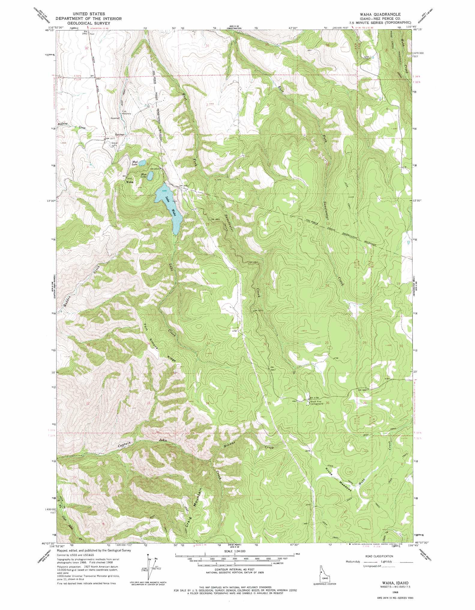
USGS Topo Quad 46116b7 - 1:24,000 scale
| Topo Map Name: | Waha |
| USGS Topo Quad ID: | 46116b7 |
| Print Size: | ca. 21 1/4" wide x 27" high |
| Southeast Coordinates: | 46.125° N latitude / 116.75° W longitude |
| Map Center Coordinates: | 46.1875° N latitude / 116.8125° W longitude |
| U.S. State: | ID |
| Filename: | o46116b7.jpg |
| Download Map JPG Image: | Waha topo map 1:24,000 scale |
| Map Type: | Topographic |
| Topo Series: | 7.5´ |
| Map Scale: | 1:24,000 |
| Source of Map Images: | United States Geological Survey (USGS) |
| Alternate Map Versions: |
Waha ID 1968, updated 1971 Download PDF Buy paper map Waha ID 1968, updated 1978 Download PDF Buy paper map Waha ID 2010 Download PDF Buy paper map Waha ID 2013 Download PDF Buy paper map |
1:24,000 Topo Quads surrounding Waha
Clarkston |
Lewiston Orchards North |
Lapwai |
Culdesac North |
Gifford |
Asotin |
Lewiston Orchards South |
Sweetwater |
Culdesac South |
Reubens |
Weissenfels Ridge |
Captain John Rapids |
Waha |
Winchester West |
Winchester East |
Black Butte |
Limekiln Rapids |
Frye Point |
Hoover Point |
Westlake |
Teepee Butte |
Jim Creek Butte |
Wapshilla Creek |
Rattlesnake Ridge |
Boles |
> Back to 46116a1 at 1:100,000 scale
> Back to 46116a1 at 1:250,000 scale
> Back to U.S. Topo Maps home
Waha topo map: Gazetteer
Waha: Flats
Kruze Meadows elevation 1431m 4694′Waha: Lakes
Blue Lake elevation 1029m 3375′Lake Waha elevation 1034m 3392′
Mud Lake elevation 981m 3218′
Waha: Populated Places
Waha elevation 1050m 3444′Waha: Ridges
Fort Simons Ridge elevation 1472m 4829′Waha: Streams
Browns Creek elevation 1094m 3589′Lake Creek elevation 1034m 3392′
Waha digital topo map on disk
Buy this Waha topo map showing relief, roads, GPS coordinates and other geographical features, as a high-resolution digital map file on DVD: