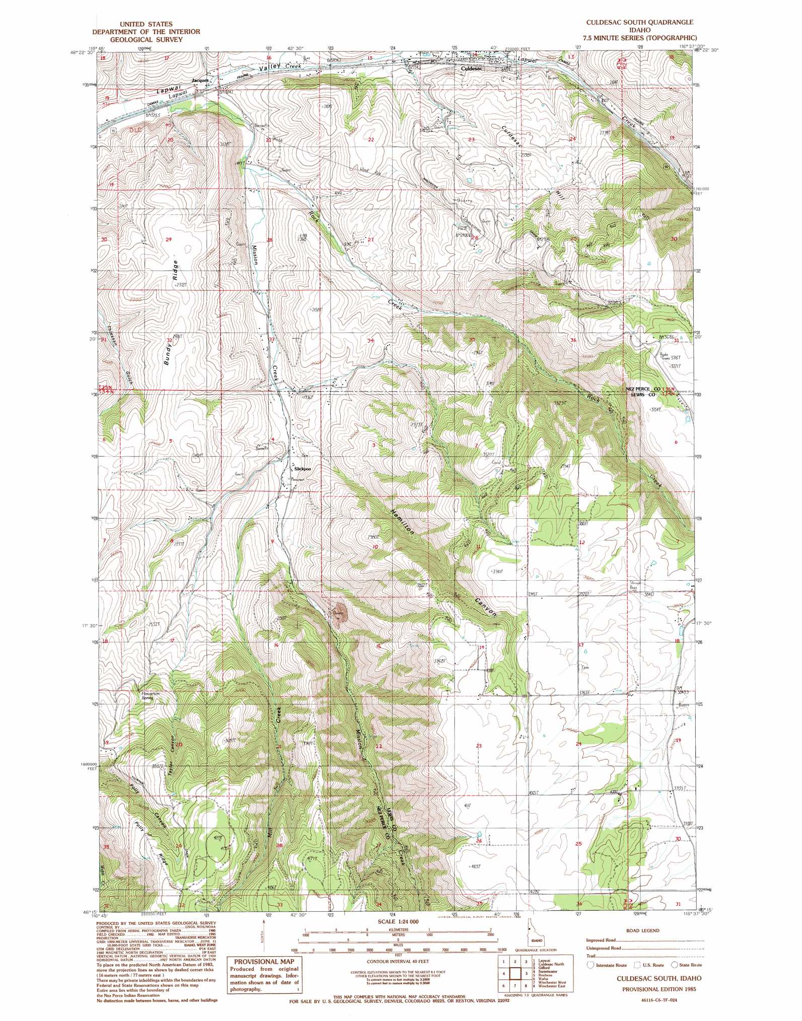
Culdesac South Topo Map Idaho
To zoom in, hover over the map of Culdesac South
USGS Topo Quad 46116c6 - 1:24,000 scale
| Topo Map Name: | Culdesac South |
| USGS Topo Quad ID: | 46116c6 |
| Print Size: | ca. 21 1/4" wide x 27" high |
| Southeast Coordinates: | 46.25° N latitude / 116.625° W longitude |
| Map Center Coordinates: | 46.3125° N latitude / 116.6875° W longitude |
| U.S. State: | ID |
| Filename: | o46116c6.jpg |
| Download Map JPG Image: | Culdesac South topo map 1:24,000 scale |
| Map Type: | Topographic |
| Topo Series: | 7.5´ |
| Map Scale: | 1:24,000 |
| Source of Map Images: | United States Geological Survey (USGS) |
| Alternate Map Versions: |
Culdesac South ID 1985, updated 1985 Download PDF Buy paper map Culdesac South ID 2010 Download PDF Buy paper map Culdesac South ID 2013 Download PDF Buy paper map |
1:24,000 Topo Quads surrounding Culdesac South
Genesee |
Green Knob |
Juliaetta |
Lenore |
Southwick |
Lewiston Orchards North |
Lapwai |
Culdesac North |
Gifford |
Peck |
Lewiston Orchards South |
Sweetwater |
Culdesac South |
Reubens |
Fletcher |
Captain John Rapids |
Waha |
Winchester West |
Winchester East |
Craigmont |
Limekiln Rapids |
Frye Point |
Hoover Point |
Westlake |
Keuterville |
> Back to 46116a1 at 1:100,000 scale
> Back to 46116a1 at 1:250,000 scale
> Back to U.S. Topo Maps home
Culdesac South topo map: Gazetteer
Culdesac South: Populated Places
Culdesac elevation 501m 1643′Fairburn (historical) elevation 1276m 4186′
Jacques elevation 426m 1397′
Slickpoo elevation 533m 1748′
Culdesac South: Ridges
Polly Ridge elevation 1232m 4041′Culdesac South: Springs
Howerton Spring elevation 865m 2837′Culdesac South: Streams
Mill Creek elevation 560m 1837′Mission Creek elevation 403m 1322′
Rock Creek elevation 444m 1456′
Culdesac South: Summits
Culdesac Hill elevation 721m 2365′Culdesac South: Valleys
Half Moon Draw elevation 444m 1456′Hamilton Canyon elevation 529m 1735′
Taylor Canyon elevation 810m 2657′
Culdesac South digital topo map on disk
Buy this Culdesac South topo map showing relief, roads, GPS coordinates and other geographical features, as a high-resolution digital map file on DVD: