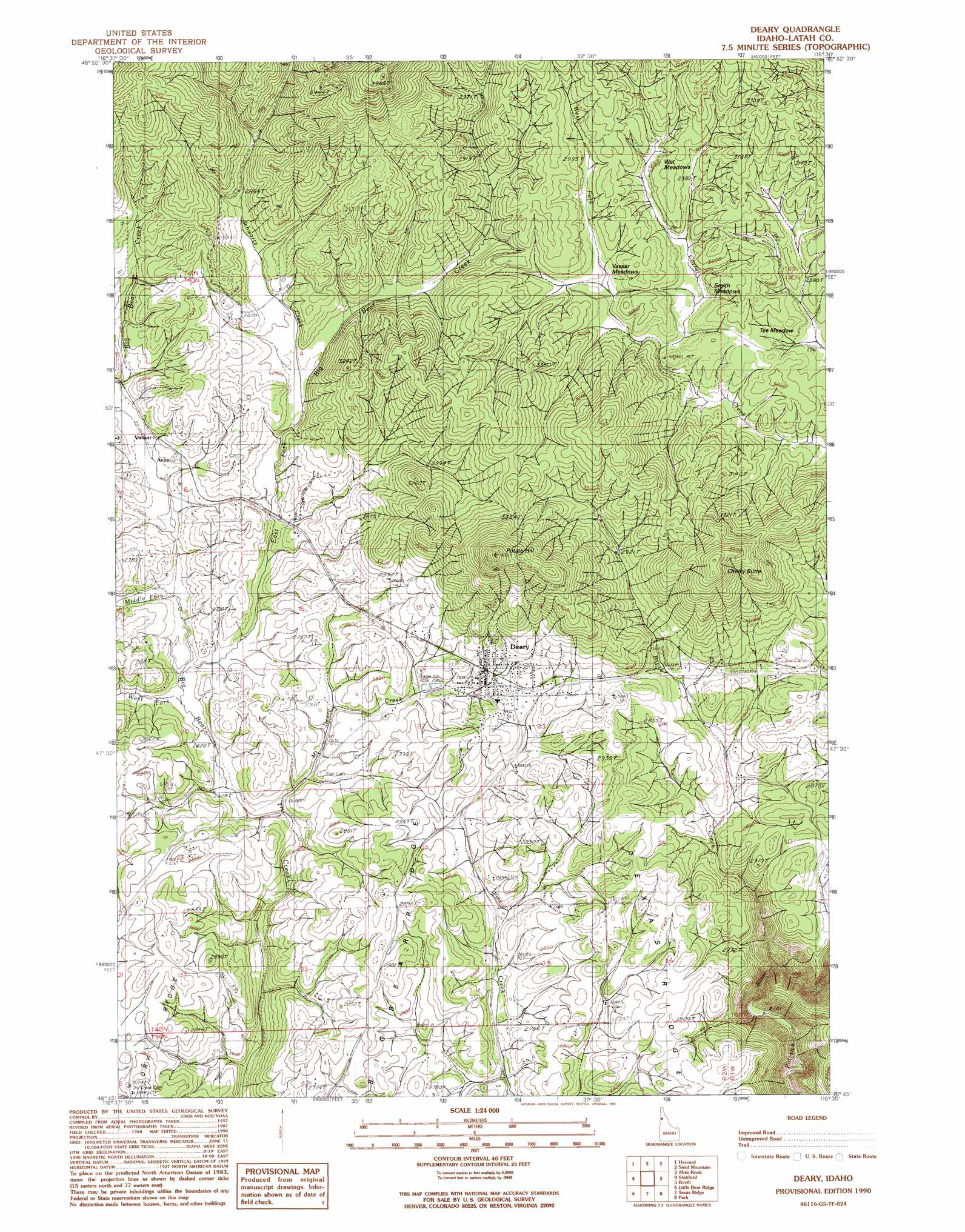
Deary Topo Map Idaho
To zoom in, hover over the map of Deary
USGS Topo Quad 46116g5 - 1:24,000 scale
| Topo Map Name: | Deary |
| USGS Topo Quad ID: | 46116g5 |
| Print Size: | ca. 21 1/4" wide x 27" high |
| Southeast Coordinates: | 46.75° N latitude / 116.5° W longitude |
| Map Center Coordinates: | 46.8125° N latitude / 116.5625° W longitude |
| U.S. State: | ID |
| Filename: | o46116g5.jpg |
| Download Map JPG Image: | Deary topo map 1:24,000 scale |
| Map Type: | Topographic |
| Topo Series: | 7.5´ |
| Map Scale: | 1:24,000 |
| Source of Map Images: | United States Geological Survey (USGS) |
| Alternate Map Versions: |
Deary ID 1990, updated 1991 Download PDF Buy paper map Deary ID 1994, updated 1997 Download PDF Buy paper map Deary ID 2011 Download PDF Buy paper map Deary ID 2014 Download PDF Buy paper map |
| FStopo: | US Forest Service topo Deary is available: Download FStopo PDF Download FStopo TIF |
1:24,000 Topo Quads surrounding Deary
Sanders |
West Dennis |
Emida |
Fernwood |
Clarkia |
Princeton |
Harvard |
Sand Mountain |
Abes Knob |
Bechtel Butte |
Moscow Mountain |
Stanford |
Deary |
Bovill |
Mcgary Butte |
Troy |
Little Bear Ridge |
Texas Ridge |
Park |
Alderman Ridge |
Green Knob |
Juliaetta |
Lenore |
Southwick |
Ahsahka |
> Back to 46116e1 at 1:100,000 scale
> Back to 46116a1 at 1:250,000 scale
> Back to U.S. Topo Maps home
Deary topo map: Gazetteer
Deary: Flats
Smith Meadows elevation 885m 2903′Vassar Meadows elevation 901m 2956′
Wet Meadows elevation 909m 2982′
Deary: Populated Places
Avon elevation 827m 2713′Deary elevation 876m 2874′
Vassar elevation 839m 2752′
Deary: Streams
Brush Creek elevation 703m 2306′East Fork Big Bear Creek elevation 805m 2641′
Middle Fork Big Bear Creek elevation 809m 2654′
Mount Deary Creek elevation 793m 2601′
Schwartz Creek elevation 851m 2791′
West Fork Big Bear Creek elevation 801m 2627′
West Fork Corral Creek elevation 885m 2903′
Deary: Summits
Benson Hill elevation 890m 2919′Cherry Butte elevation 1124m 3687′
Potato Hill elevation 1204m 3950′
Deary digital topo map on disk
Buy this Deary topo map showing relief, roads, GPS coordinates and other geographical features, as a high-resolution digital map file on DVD: