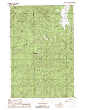
Bechtel Butte Topo Map Idaho
To zoom in, hover over the map of Bechtel Butte
USGS Topo Quad 46116h3 - 1:24,000 scale
| Topo Map Name: | Bechtel Butte |
| USGS Topo Quad ID: | 46116h3 |
| Print Size: | ca. 21 1/4" wide x 27" high |
| Southeast Coordinates: | 46.875° N latitude / 116.25° W longitude |
| Map Center Coordinates: | 46.9375° N latitude / 116.3125° W longitude |
| U.S. State: | ID |
| Filename: | o46116h3.jpg |
| Download Map JPG Image: | Bechtel Butte topo map 1:24,000 scale |
| Map Type: | Topographic |
| Topo Series: | 7.5´ |
| Map Scale: | 1:24,000 |
| Source of Map Images: | United States Geological Survey (USGS) |
| Alternate Map Versions: |
Bechtel Butte ID 1990, updated 1991 Download PDF Buy paper map Bechtel Butte ID 1994, updated 1997 Download PDF Buy paper map Bechtel Butte ID 2011 Download PDF Buy paper map Bechtel Butte ID 2014 Download PDF Buy paper map |
| FStopo: | US Forest Service topo Bechtel Butte is available: Download FStopo PDF Download FStopo TIF |
1:24,000 Topo Quads surrounding Bechtel Butte
> Back to 46116e1 at 1:100,000 scale
> Back to 46116a1 at 1:250,000 scale
> Back to U.S. Topo Maps home
Bechtel Butte topo map: Gazetteer
Bechtel Butte: Areas
Emerald Creek Garnet Area elevation 899m 2949′Bechtel Butte: Flats
Badger Meadows elevation 971m 3185′Bechtel Butte: Populated Places
Keeler elevation 906m 2972′Sherwin elevation 979m 3211′
Bechtel Butte: Streams
Bechtel Creek elevation 869m 2851′Cat Spur Creek elevation 876m 2874′
Head Creek elevation 914m 2998′
Hidden Creek elevation 901m 2956′
Keeler Creek elevation 909m 2982′
Lamb Creek elevation 922m 3024′
Little East Fork Emerald Creek elevation 902m 2959′
Log Creek elevation 898m 2946′
Long Slim Creek elevation 888m 2913′
Mallory Creek elevation 951m 3120′
Mazie Creek elevation 873m 2864′
Pasture Creek elevation 908m 2979′
Wood Creek elevation 896m 2939′
Bechtel Butte: Summits
Bechtel Butte elevation 1418m 4652′Caterpillar Hill elevation 1131m 3710′
Sherwin Point elevation 1236m 4055′
Bechtel Butte: Valleys
Garnet Gulch elevation 920m 3018′Bechtel Butte digital topo map on disk
Buy this Bechtel Butte topo map showing relief, roads, GPS coordinates and other geographical features, as a high-resolution digital map file on DVD:


