Black Butte Topo Map Washington
To zoom in, hover over the map of Black Butte
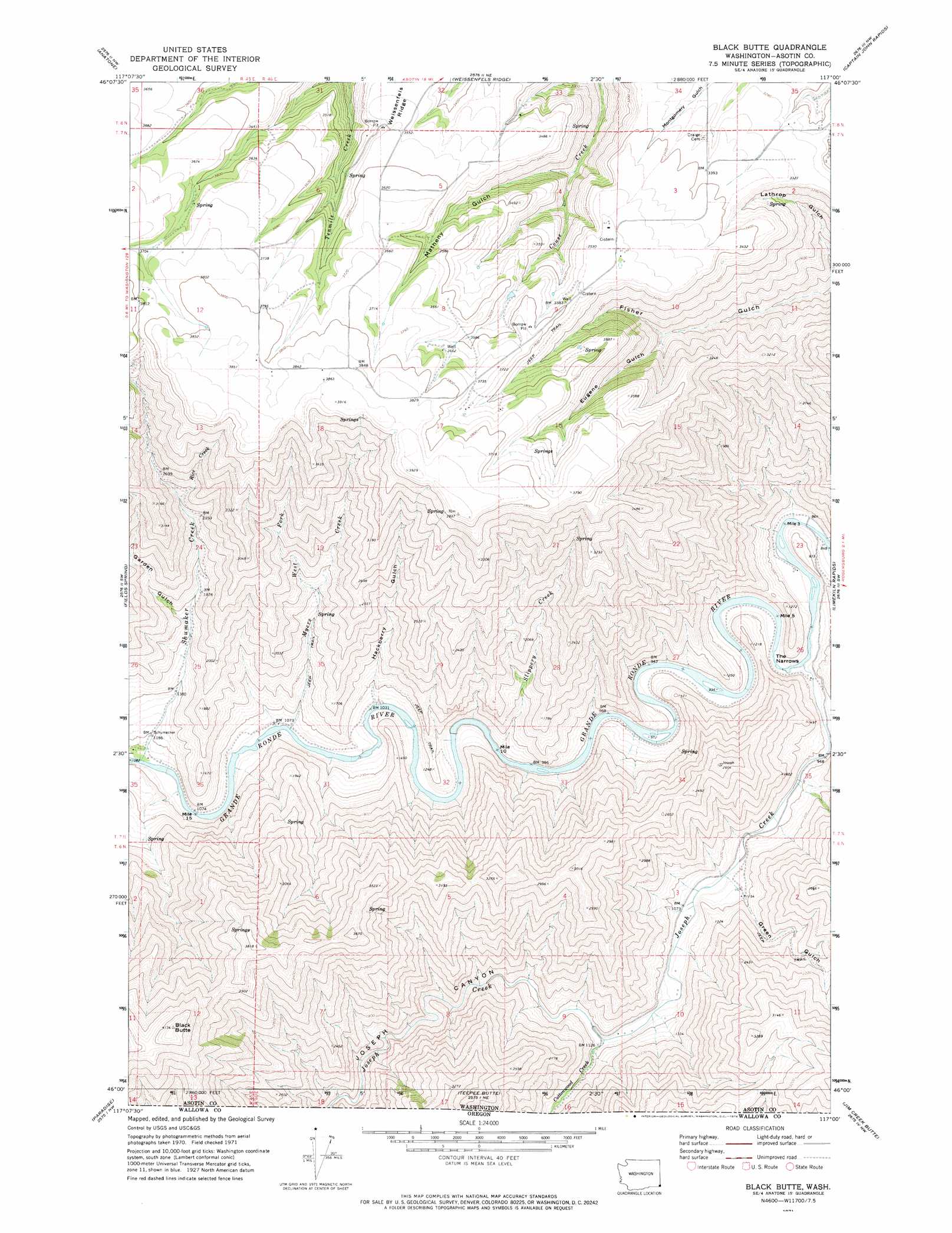
USGS Topo Quad 46117a1 - 1:24,000 scale
| Topo Map Name: | Black Butte |
| USGS Topo Quad ID: | 46117a1 |
| Print Size: | ca. 21 1/4" wide x 27" high |
| Southeast Coordinates: | 46° N latitude / 117° W longitude |
| Map Center Coordinates: | 46.0625° N latitude / 117.0625° W longitude |
| U.S. State: | WA |
| Filename: | o46117a1.jpg |
| Download Map JPG Image: | Black Butte topo map 1:24,000 scale |
| Map Type: | Topographic |
| Topo Series: | 7.5´ |
| Map Scale: | 1:24,000 |
| Source of Map Images: | United States Geological Survey (USGS) |
| Alternate Map Versions: |
Black Butte WA 1971, updated 1974 Download PDF Buy paper map Black Butte WA 1971, updated 1974 Download PDF Buy paper map Black Butte WA 2011 Download PDF Buy paper map Black Butte WA 2014 Download PDF Buy paper map |
| FStopo: | US Forest Service topo Black Butte is available: Download FStopo PDF Download FStopo TIF |
1:24,000 Topo Quads surrounding Black Butte
Potter Hill |
Rockpile Creek |
Asotin |
Lewiston Orchards South |
Sweetwater |
Harlow Ridge |
Anatone |
Weissenfels Ridge |
Captain John Rapids |
Waha |
Mountain View |
Fields Spring |
Black Butte |
Limekiln Rapids |
Frye Point |
Flora |
Paradise |
Teepee Butte |
Jim Creek Butte |
Wapshilla Creek |
Shamrock Creek |
Table Mountain |
Billy Meadows |
Poison Point |
Deadhorse Ridge |
> Back to 46117a1 at 1:100,000 scale
> Back to 46116a1 at 1:250,000 scale
> Back to U.S. Topo Maps home
Black Butte topo map: Gazetteer
Black Butte: Gaps
The Narrows elevation 270m 885′Black Butte: Parks
Chief Joseph State Wildlife Recreation Area elevation 467m 1532′Black Butte: Streams
Cottonwood Creek elevation 340m 1115′Cottonwood Creek elevation 340m 1115′
Joseph Creek elevation 271m 889′
Joseph Creek elevation 271m 889′
Myers Creek elevation 332m 1089′
Rice Creek elevation 738m 2421′
Shumaker Creek elevation 333m 1092′
Slippery Creek elevation 320m 1049′
West Fork Myers Creek elevation 553m 1814′
Black Butte: Summits
Black Butte elevation 1261m 4137′Black Butte: Valleys
Eugene Gulch elevation 810m 2657′Garden Gulch elevation 529m 1735′
Green Gulch elevation 333m 1092′
Hackberry Gulch elevation 324m 1062′
Joseph Canyon elevation 344m 1128′
Joseph Canyon elevation 344m 1128′
Matheny Gulch elevation 887m 2910′
Black Butte digital topo map on disk
Buy this Black Butte topo map showing relief, roads, GPS coordinates and other geographical features, as a high-resolution digital map file on DVD: