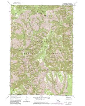
Oregon Butte Topo Map Washington
To zoom in, hover over the map of Oregon Butte
USGS Topo Quad 46117a6 - 1:24,000 scale
| Topo Map Name: | Oregon Butte |
| USGS Topo Quad ID: | 46117a6 |
| Print Size: | ca. 21 1/4" wide x 27" high |
| Southeast Coordinates: | 46° N latitude / 117.625° W longitude |
| Map Center Coordinates: | 46.0625° N latitude / 117.6875° W longitude |
| U.S. State: | WA |
| Filename: | o46117a6.jpg |
| Download Map JPG Image: | Oregon Butte topo map 1:24,000 scale |
| Map Type: | Topographic |
| Topo Series: | 7.5´ |
| Map Scale: | 1:24,000 |
| Source of Map Images: | United States Geological Survey (USGS) |
| Alternate Map Versions: |
Oregon Butte WA 1967, updated 1971 Download PDF Buy paper map Oregon Butte WA 1967, updated 1977 Download PDF Buy paper map Oregon Butte WA 1967, updated 1983 Download PDF Buy paper map Oregon Butte WA 1995, updated 1998 Download PDF Buy paper map Oregon Butte WA 2011 Download PDF Buy paper map Oregon Butte WA 2014 Download PDF Buy paper map |
| FStopo: | US Forest Service topo Oregon Butte is available: Download FStopo PDF Download FStopo TIF |
1:24,000 Topo Quads surrounding Oregon Butte
> Back to 46117a1 at 1:100,000 scale
> Back to 46116a1 at 1:250,000 scale
> Back to U.S. Topo Maps home
Oregon Butte topo map: Gazetteer
Oregon Butte: Cliffs
Danger Point elevation 1638m 5374′Oregon Butte: Flats
Ant Flat elevation 1283m 4209′Oregon Butte: Ridges
French Ridge elevation 1322m 4337′Grizzly Bear Ridge elevation 1718m 5636′
Patterson Ridge elevation 1294m 4245′
Patterson Ridge elevation 1294m 4245′
Rattlesnake Ridge elevation 1267m 4156′
Rattlesnake Ridge elevation 1282m 4206′
Yearling Ridge elevation 1624m 5328′
Oregon Butte: Springs
Emergency Spring elevation 1837m 6026′Hatfield Spring elevation 1759m 5770′
Huckleberry Spring elevation 1626m 5334′
Little Turkey Spring elevation 1720m 5643′
Lodgepole Spring elevation 1586m 5203′
McBain Spring elevation 1632m 5354′
Moolack Spring elevation 1754m 5754′
Oregon Butte Spring elevation 1853m 6079′
Pearson Spring elevation 1576m 5170′
Rettkowski Spring elevation 1614m 5295′
Ruth Spring elevation 1619m 5311′
Taylor Spring elevation 1644m 5393′
Teepee Spring elevation 1638m 5374′
Twin Spring elevation 1475m 4839′
Oregon Butte: Streams
Cougar Creek elevation 1004m 3293′Dickinson Creek elevation 956m 3136′
East Fork Butte Creek elevation 951m 3120′
King Creek elevation 1089m 3572′
Trout Creek elevation 979m 3211′
West Fork Butte Creek elevation 951m 3120′
Oregon Butte: Summits
Oregon Butte elevation 1929m 6328′Weller Butte elevation 1684m 5524′
West Butte elevation 1909m 6263′
Oregon Butte: Trails
East Butte Creek Trail elevation 1045m 3428′Smooth Ridge Trail elevation 1526m 5006′
Oregon Butte: Valleys
Box Canyon elevation 865m 2837′Oregon Butte digital topo map on disk
Buy this Oregon Butte topo map showing relief, roads, GPS coordinates and other geographical features, as a high-resolution digital map file on DVD:


