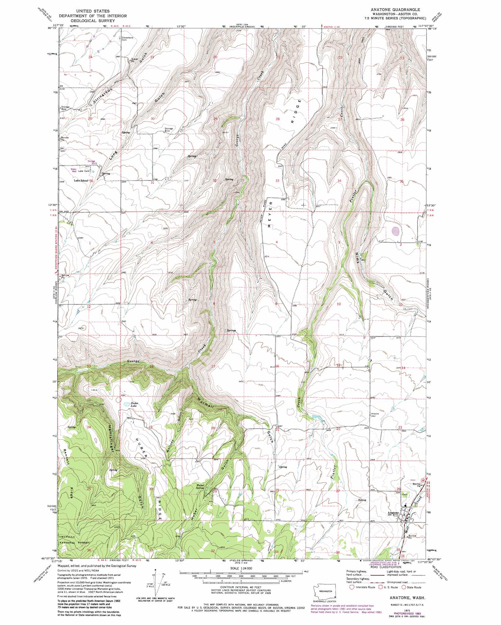
Anatone Topo Map Washington
To zoom in, hover over the map of Anatone
USGS Topo Quad 46117b2 - 1:24,000 scale
| Topo Map Name: | Anatone |
| USGS Topo Quad ID: | 46117b2 |
| Print Size: | ca. 21 1/4" wide x 27" high |
| Southeast Coordinates: | 46.125° N latitude / 117.125° W longitude |
| Map Center Coordinates: | 46.1875° N latitude / 117.1875° W longitude |
| U.S. State: | WA |
| Filename: | o46117b2.jpg |
| Download Map JPG Image: | Anatone topo map 1:24,000 scale |
| Map Type: | Topographic |
| Topo Series: | 7.5´ |
| Map Scale: | 1:24,000 |
| Source of Map Images: | United States Geological Survey (USGS) |
| Alternate Map Versions: |
Anatone WA 1971, updated 1973 Download PDF Buy paper map Anatone WA 1971, updated 1983 Download PDF Buy paper map Anatone WA 1995, updated 1998 Download PDF Buy paper map Anatone WA 2011 Download PDF Buy paper map Anatone WA 2014 Download PDF Buy paper map |
| FStopo: | US Forest Service topo Anatone is available: Download FStopo PDF Download FStopo TIF |
1:24,000 Topo Quads surrounding Anatone
Alpowa Ridge |
Stember Creek |
Silcott Island |
Clarkston |
Lewiston Orchards North |
Peola |
Potter Hill |
Rockpile Creek |
Asotin |
Lewiston Orchards South |
Pinkham Butte |
Harlow Ridge |
Anatone |
Weissenfels Ridge |
Captain John Rapids |
Saddle Butte |
Mountain View |
Fields Spring |
Black Butte |
Limekiln Rapids |
Troy |
Flora |
Paradise |
Teepee Butte |
Jim Creek Butte |
> Back to 46117a1 at 1:100,000 scale
> Back to 46116a1 at 1:250,000 scale
> Back to U.S. Topo Maps home
Anatone topo map: Gazetteer
Anatone: Lakes
Huber Lake elevation 1095m 3592′Anatone: Populated Places
Anatone elevation 1085m 3559′Anatone: Ridges
Bennett Ridge elevation 1199m 3933′Huber Ridge elevation 1205m 3953′
Meyer Ridge elevation 941m 3087′
Anatone: Springs
Huber Spring elevation 971m 3185′Anatone: Valleys
Hefflefinger Gulch elevation 896m 2939′Huber Gulch elevation 958m 3143′
Nims Gulch elevation 792m 2598′
Whitney Gulch elevation 846m 2775′
Wormell Gulch elevation 808m 2650′
Anatone digital topo map on disk
Buy this Anatone topo map showing relief, roads, GPS coordinates and other geographical features, as a high-resolution digital map file on DVD: