Rockpile Creek Topo Map Washington
To zoom in, hover over the map of Rockpile Creek
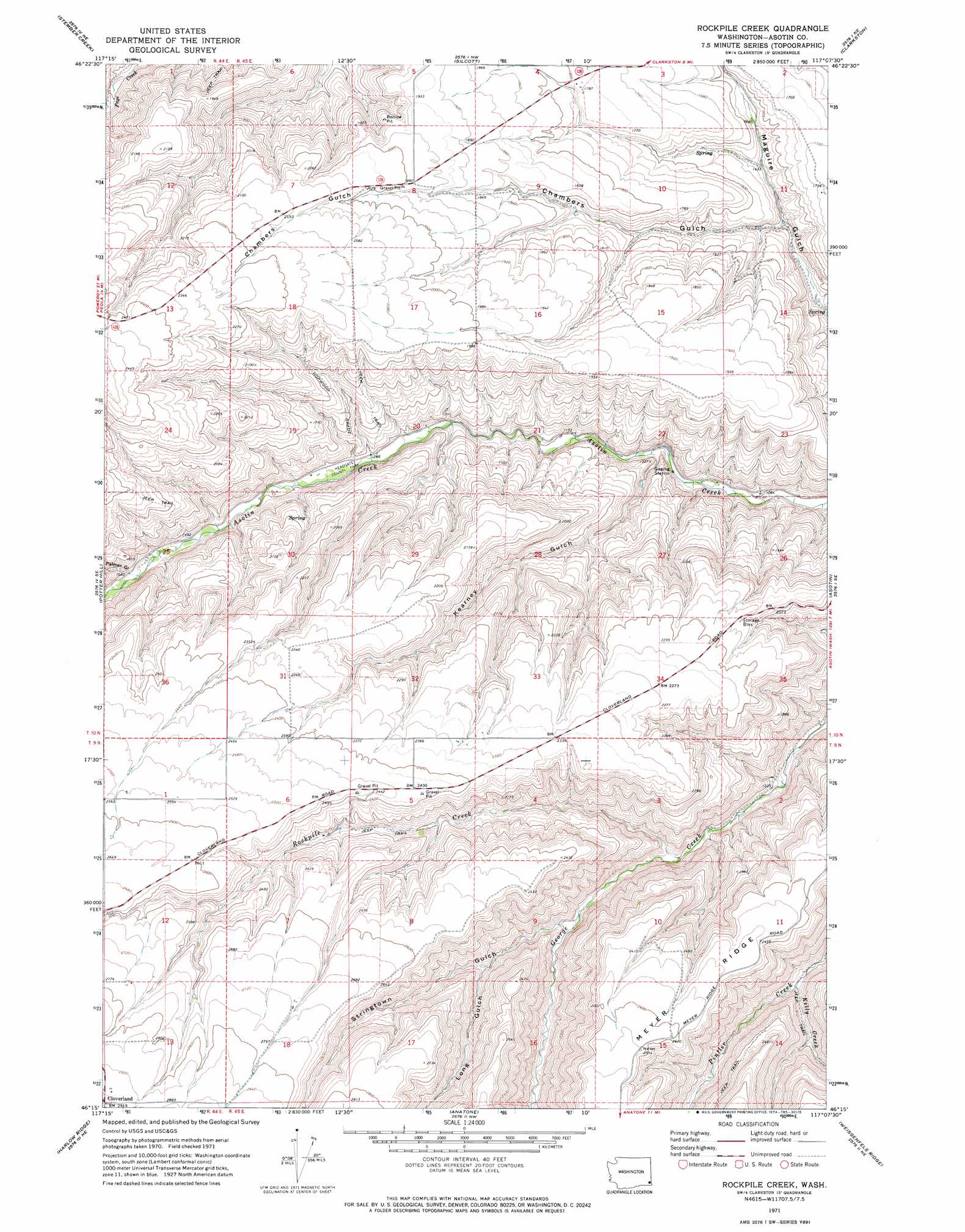
USGS Topo Quad 46117c2 - 1:24,000 scale
| Topo Map Name: | Rockpile Creek |
| USGS Topo Quad ID: | 46117c2 |
| Print Size: | ca. 21 1/4" wide x 27" high |
| Southeast Coordinates: | 46.25° N latitude / 117.125° W longitude |
| Map Center Coordinates: | 46.3125° N latitude / 117.1875° W longitude |
| U.S. State: | WA |
| Filename: | o46117c2.jpg |
| Download Map JPG Image: | Rockpile Creek topo map 1:24,000 scale |
| Map Type: | Topographic |
| Topo Series: | 7.5´ |
| Map Scale: | 1:24,000 |
| Source of Map Images: | United States Geological Survey (USGS) |
| Alternate Map Versions: |
Rockpile Creek WA 1971, updated 1974 Download PDF Buy paper map Rockpile Creek WA 2011 Download PDF Buy paper map Rockpile Creek WA 2013 Download PDF Buy paper map |
1:24,000 Topo Quads surrounding Rockpile Creek
Kirby |
Granite Point |
Colton |
Uniontown |
Genesee |
Alpowa Ridge |
Stember Creek |
Silcott Island |
Clarkston |
Lewiston Orchards North |
Peola |
Potter Hill |
Rockpile Creek |
Asotin |
Lewiston Orchards South |
Pinkham Butte |
Harlow Ridge |
Anatone |
Weissenfels Ridge |
Captain John Rapids |
Saddle Butte |
Mountain View |
Fields Spring |
Black Butte |
Limekiln Rapids |
> Back to 46117a1 at 1:100,000 scale
> Back to 46116a1 at 1:250,000 scale
> Back to U.S. Topo Maps home
Rockpile Creek topo map: Gazetteer
Rockpile Creek: Parks
Headgate County Park elevation 416m 1364′Rockpile Creek: Streams
Kelly Creek elevation 499m 1637′Rockpile Creek elevation 425m 1394′
Rockpile Creek: Valleys
Chambers Gulch elevation 417m 1368′Kearnery Gulch elevation 352m 1154′
Long Gulch elevation 561m 1840′
Palmer Gulch elevation 468m 1535′
Stringtown Gulch elevation 482m 1581′
Rockpile Creek digital topo map on disk
Buy this Rockpile Creek topo map showing relief, roads, GPS coordinates and other geographical features, as a high-resolution digital map file on DVD: