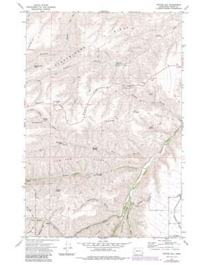
Potter Hill Topo Map Washington
To zoom in, hover over the map of Potter Hill
USGS Topo Quad 46117c3 - 1:24,000 scale
| Topo Map Name: | Potter Hill |
| USGS Topo Quad ID: | 46117c3 |
| Print Size: | ca. 21 1/4" wide x 27" high |
| Southeast Coordinates: | 46.25° N latitude / 117.25° W longitude |
| Map Center Coordinates: | 46.3125° N latitude / 117.3125° W longitude |
| U.S. State: | WA |
| Filename: | o46117c3.jpg |
| Download Map JPG Image: | Potter Hill topo map 1:24,000 scale |
| Map Type: | Topographic |
| Topo Series: | 7.5´ |
| Map Scale: | 1:24,000 |
| Source of Map Images: | United States Geological Survey (USGS) |
| Alternate Map Versions: |
Potter Hill WA 1971, updated 1974 Download PDF Buy paper map Potter Hill WA 1971, updated 1983 Download PDF Buy paper map Potter Hill WA 1995, updated 1998 Download PDF Buy paper map Potter Hill WA 2011 Download PDF Buy paper map Potter Hill WA 2013 Download PDF Buy paper map |
| FStopo: | US Forest Service topo Potter Hill is available: Download FStopo PDF Download FStopo TIF |
1:24,000 Topo Quads surrounding Potter Hill
> Back to 46117a1 at 1:100,000 scale
> Back to 46116a1 at 1:250,000 scale
> Back to U.S. Topo Maps home
Potter Hill topo map: Gazetteer
Potter Hill: Capes
Bracken Point elevation 809m 2654′Potter Hill: Parks
Asotin State Wildlife Recreation Area elevation 605m 1984′Potter Hill: Populated Places
Cloverland elevation 895m 2936′Potter Hill: Ridges
Flerchinger Ridge elevation 746m 2447′Pleasant Ridge elevation 946m 3103′
Rubenser Ridge elevation 964m 3162′
Tam Tam Ridge elevation 961m 3152′
The Gooseneck elevation 842m 2762′
Potter Hill: Springs
Blankenship Spring elevation 755m 2477′Buckley Springs elevation 662m 2171′
Cottonwood Spring elevation 613m 2011′
Foredyce Spring elevation 951m 3120′
Laufer Spring elevation 669m 2194′
Rimmelspacher Spring elevation 800m 2624′
Schuelke Spring elevation 862m 2828′
Potter Hill: Streams
Charley Creek elevation 519m 1702′Lick Creek elevation 590m 1935′
North Fork Asotin Creek elevation 563m 1847′
South Fork Asotin Creek elevation 563m 1847′
Potter Hill: Summits
Potter Hill elevation 1040m 3412′Potter Hill: Valleys
Bachelor Gulch elevation 638m 2093′Blankenship Gulch elevation 747m 2450′
Conner Gulch elevation 535m 1755′
Cottonwood Gulch elevation 862m 2828′
Dry Gulch elevation 509m 1669′
Schuelke Gulch elevation 863m 2831′
Sourdough Gulch elevation 838m 2749′
Wolf Gulch elevation 722m 2368′
Potter Hill digital topo map on disk
Buy this Potter Hill topo map showing relief, roads, GPS coordinates and other geographical features, as a high-resolution digital map file on DVD:


