Dayton Topo Map Washington
To zoom in, hover over the map of Dayton
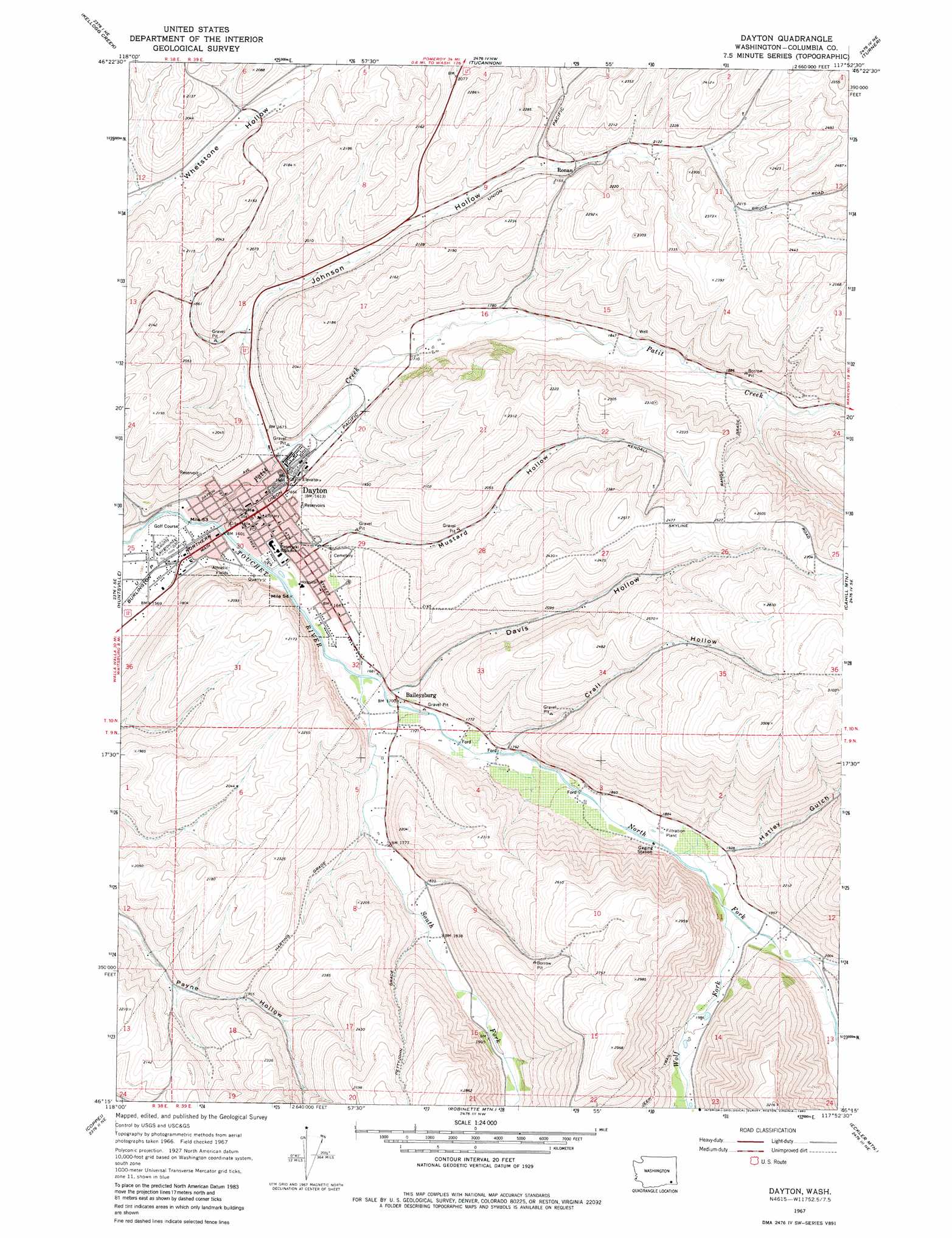
USGS Topo Quad 46117c8 - 1:24,000 scale
| Topo Map Name: | Dayton |
| USGS Topo Quad ID: | 46117c8 |
| Print Size: | ca. 21 1/4" wide x 27" high |
| Southeast Coordinates: | 46.25° N latitude / 117.875° W longitude |
| Map Center Coordinates: | 46.3125° N latitude / 117.9375° W longitude |
| U.S. State: | WA |
| Filename: | o46117c8.jpg |
| Download Map JPG Image: | Dayton topo map 1:24,000 scale |
| Map Type: | Topographic |
| Topo Series: | 7.5´ |
| Map Scale: | 1:24,000 |
| Source of Map Images: | United States Geological Survey (USGS) |
| Alternate Map Versions: |
Dayton WA 1967, updated 1971 Download PDF Buy paper map Dayton WA 1967, updated 1982 Download PDF Buy paper map Dayton WA 2011 Download PDF Buy paper map Dayton WA 2014 Download PDF Buy paper map |
1:24,000 Topo Quads surrounding Dayton
Starbuck West |
Starbuck East |
Delaney |
Dodge |
Falling Springs |
Waitsburg Nw |
Kellogg Creek |
Tucannon |
Turner |
Zumwalt |
Waitsburg |
Huntsville |
Dayton |
Cahill Mountain |
Hopkins Ridge |
Dixie |
Coppei |
Robinette Mountain |
Eckler Mountain |
Panjab Creek |
Buroker |
Kooskooskie |
Deadman Peak |
Godman Spring |
Oregon Butte |
> Back to 46117a1 at 1:100,000 scale
> Back to 46116a1 at 1:250,000 scale
> Back to U.S. Topo Maps home
Dayton topo map: Gazetteer
Dayton: Populated Places
Baileysburg elevation 524m 1719′Dayton elevation 506m 1660′
Ronan elevation 627m 2057′
Dayton: Streams
North Fork Touchet River elevation 508m 1666′Patit Creek elevation 488m 1601′
South Fork Touchet River elevation 508m 1666′
Wolf Fork elevation 580m 1902′
Dayton: Valleys
Crall Hollow elevation 551m 1807′Davis Hollow elevation 529m 1735′
Hatley Gulch elevation 586m 1922′
Johnson Hollow elevation 501m 1643′
Mustard Hollow elevation 508m 1666′
Rodgers Gulch elevation 606m 1988′
Dayton digital topo map on disk
Buy this Dayton topo map showing relief, roads, GPS coordinates and other geographical features, as a high-resolution digital map file on DVD: