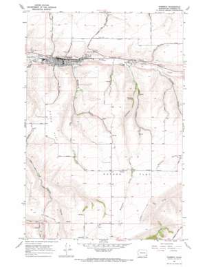
Pomeroy Topo Map Washington
To zoom in, hover over the map of Pomeroy
USGS Topo Quad 46117d5 - 1:24,000 scale
| Topo Map Name: | Pomeroy |
| USGS Topo Quad ID: | 46117d5 |
| Print Size: | ca. 21 1/4" wide x 27" high |
| Southeast Coordinates: | 46.375° N latitude / 117.5° W longitude |
| Map Center Coordinates: | 46.4375° N latitude / 117.5625° W longitude |
| U.S. State: | WA |
| Filename: | o46117d5.jpg |
| Download Map JPG Image: | Pomeroy topo map 1:24,000 scale |
| Map Type: | Topographic |
| Topo Series: | 7.5´ |
| Map Scale: | 1:24,000 |
| Source of Map Images: | United States Geological Survey (USGS) |
| Alternate Map Versions: |
Pomeroy WA 1967, updated 1971 Download PDF Buy paper map Pomeroy WA 2011 Download PDF Buy paper map Pomeroy WA 2013 Download PDF Buy paper map |
1:24,000 Topo Quads surrounding Pomeroy
> Back to 46117a1 at 1:100,000 scale
> Back to 46116a1 at 1:250,000 scale
> Back to U.S. Topo Maps home
Pomeroy topo map: Gazetteer
Pomeroy: Airports
Ferrell Field elevation 715m 2345′Pomeroy: Flats
Dutch Flat elevation 790m 2591′Pataha Flat elevation 917m 3008′
Pomeroy: Populated Places
Pataha elevation 629m 2063′Pomeroy elevation 566m 1856′
Pomeroy: Springs
Bihmaier Springs elevation 684m 2244′Butler Spring elevation 613m 2011′
Pomeroy: Valleys
Benjamin Gulch elevation 576m 1889′Bihmaier Gulch elevation 620m 2034′
Brown Gulch elevation 611m 2004′
Geiger Gulch elevation 545m 1788′
Hutchens Gulch elevation 663m 2175′
Rickman Gulch elevation 747m 2450′
Pomeroy digital topo map on disk
Buy this Pomeroy topo map showing relief, roads, GPS coordinates and other geographical features, as a high-resolution digital map file on DVD:


