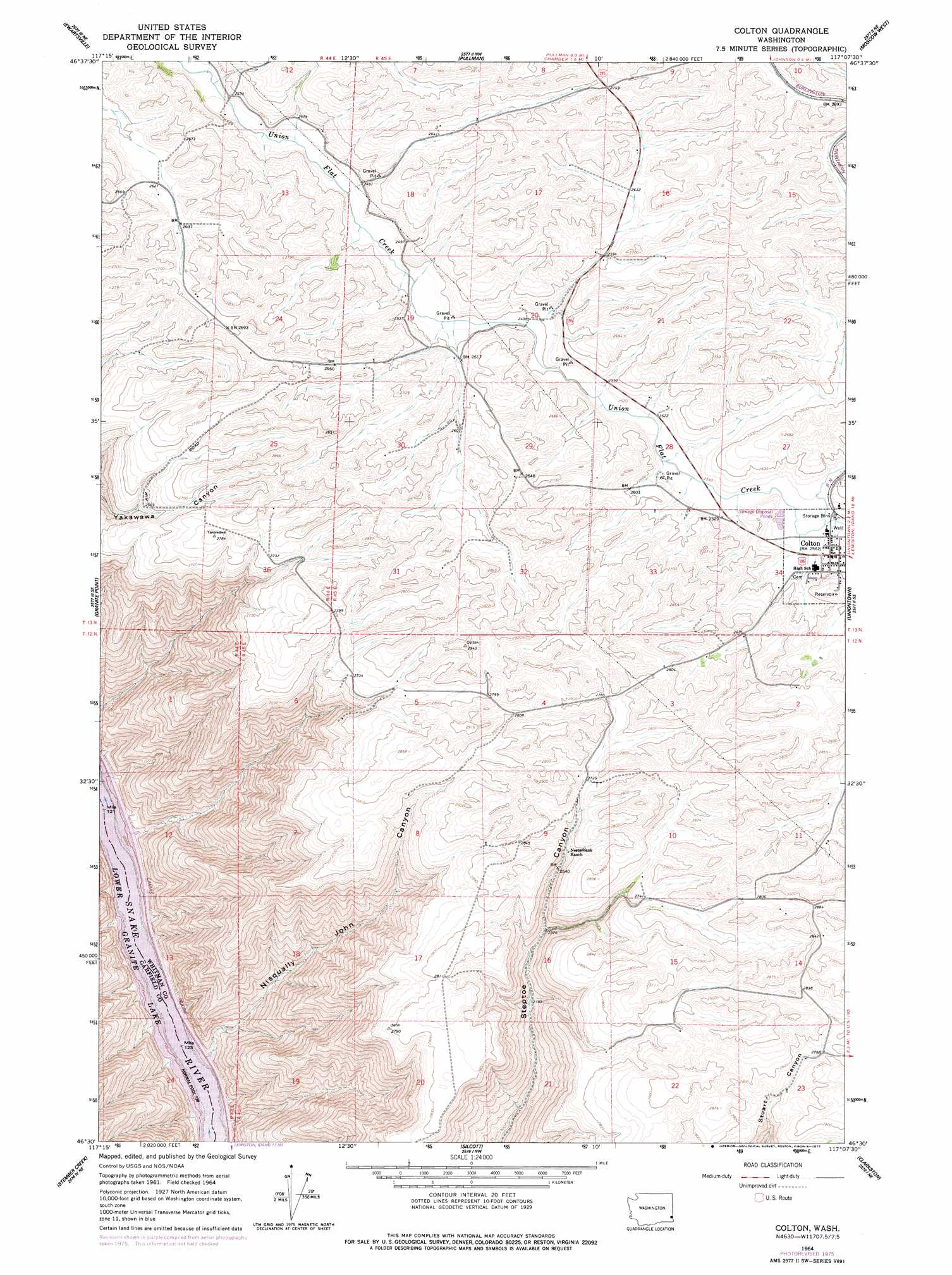
Colton Topo Map Washington
To zoom in, hover over the map of Colton
USGS Topo Quad 46117e2 - 1:24,000 scale
| Topo Map Name: | Colton |
| USGS Topo Quad ID: | 46117e2 |
| Print Size: | ca. 21 1/4" wide x 27" high |
| Southeast Coordinates: | 46.5° N latitude / 117.125° W longitude |
| Map Center Coordinates: | 46.5625° N latitude / 117.1875° W longitude |
| U.S. State: | WA |
| Filename: | o46117e2.jpg |
| Download Map JPG Image: | Colton topo map 1:24,000 scale |
| Map Type: | Topographic |
| Topo Series: | 7.5´ |
| Map Scale: | 1:24,000 |
| Source of Map Images: | United States Geological Survey (USGS) |
| Alternate Map Versions: |
Colton WA 1964, updated 1965 Download PDF Buy paper map Colton WA 1964, updated 1977 Download PDF Buy paper map Colton WA 2011 Download PDF Buy paper map Colton WA 2013 Download PDF Buy paper map |
1:24,000 Topo Quads surrounding Colton
Wilcox |
Colfax South |
Albion |
Viola |
Robinson Lake |
Almota |
Ewartsville |
Pullman |
Moscow West |
Moscow East |
Kirby |
Granite Point |
Colton |
Uniontown |
Genesee |
Alpowa Ridge |
Stember Creek |
Silcott Island |
Clarkston |
Lewiston Orchards North |
Peola |
Potter Hill |
Rockpile Creek |
Asotin |
Lewiston Orchards South |
> Back to 46117e1 at 1:100,000 scale
> Back to 46116a1 at 1:250,000 scale
> Back to U.S. Topo Maps home
Colton topo map: Gazetteer
Colton: Populated Places
Colton elevation 781m 2562′Colton: Valleys
Nisqually John Canyon elevation 230m 754′Schultheis Canyon elevation 231m 757′
Colton digital topo map on disk
Buy this Colton topo map showing relief, roads, GPS coordinates and other geographical features, as a high-resolution digital map file on DVD: