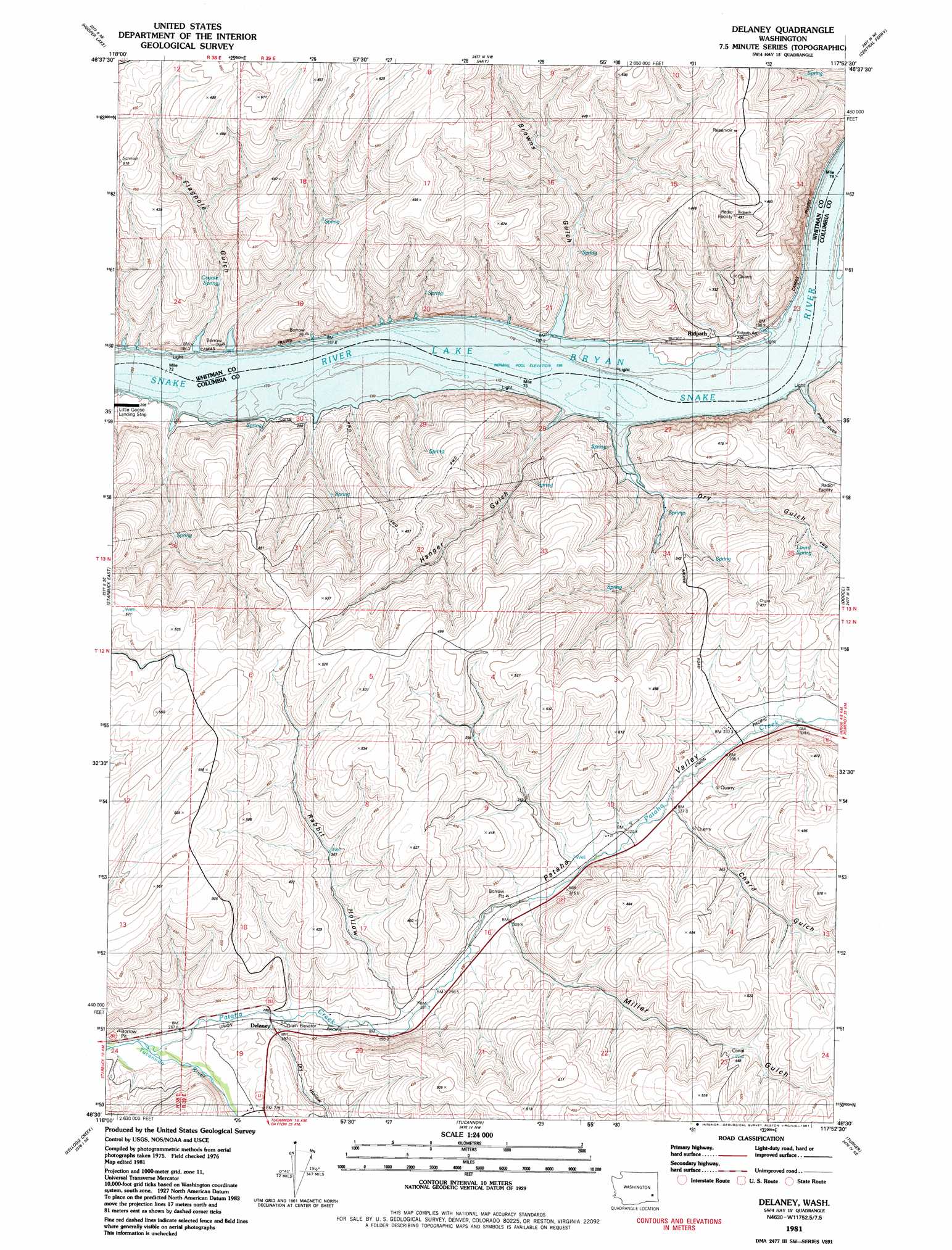
Delaney Topo Map Washington
To zoom in, hover over the map of Delaney
USGS Topo Quad 46117e8 - 1:24,000 scale
| Topo Map Name: | Delaney |
| USGS Topo Quad ID: | 46117e8 |
| Print Size: | ca. 21 1/4" wide x 27" high |
| Southeast Coordinates: | 46.5° N latitude / 117.875° W longitude |
| Map Center Coordinates: | 46.5625° N latitude / 117.9375° W longitude |
| U.S. State: | WA |
| Filename: | o46117e8.jpg |
| Download Map JPG Image: | Delaney topo map 1:24,000 scale |
| Map Type: | Topographic |
| Topo Series: | 7.5´ |
| Map Scale: | 1:24,000 |
| Source of Map Images: | United States Geological Survey (USGS) |
| Alternate Map Versions: |
Delaney WA 1981, updated 1981 Download PDF Buy paper map Delaney WA 2011 Download PDF Buy paper map Delaney WA 2014 Download PDF Buy paper map |
1:24,000 Topo Quads surrounding Delaney
Hooper |
Rattlesnake Canyon |
La Crosse West |
La Crosse East |
Dusty |
Palouse Falls |
Hooper Lake |
Hay |
Central Ferry |
Ping |
Starbuck West |
Starbuck East |
Delaney |
Dodge |
Falling Springs |
Waitsburg Nw |
Kellogg Creek |
Tucannon |
Turner |
Zumwalt |
Waitsburg |
Huntsville |
Dayton |
Cahill Mountain |
Hopkins Ridge |
> Back to 46117e1 at 1:100,000 scale
> Back to 46116a1 at 1:250,000 scale
> Back to U.S. Topo Maps home
Delaney topo map: Gazetteer
Delaney: Bars
Revere Bar elevation 196m 643′Delaney: Bays
Little Goose Bay elevation 196m 643′Delaney: Populated Places
Delaney elevation 280m 918′Jackson elevation 324m 1062′
Ridpath elevation 196m 643′
Wild Goose elevation 196m 643′
Delaney: Springs
Coyote Spring elevation 242m 793′Lizard Spring elevation 304m 997′
Delaney: Streams
Pataha Creek elevation 260m 853′Delaney: Valleys
Browns Gulch elevation 196m 643′Chard Gulch elevation 326m 1069′
Dry Gulch elevation 196m 643′
Dry Hollow elevation 282m 925′
Flagpole Gulch elevation 196m 643′
Hanger Gulch elevation 196m 643′
Miller Gulch elevation 311m 1020′
Pataha Valley elevation 260m 853′
Phalen Gulch elevation 196m 643′
Rabbit Hollow elevation 290m 951′
Delaney digital topo map on disk
Buy this Delaney topo map showing relief, roads, GPS coordinates and other geographical features, as a high-resolution digital map file on DVD: