Central Ferry Topo Map Washington
To zoom in, hover over the map of Central Ferry
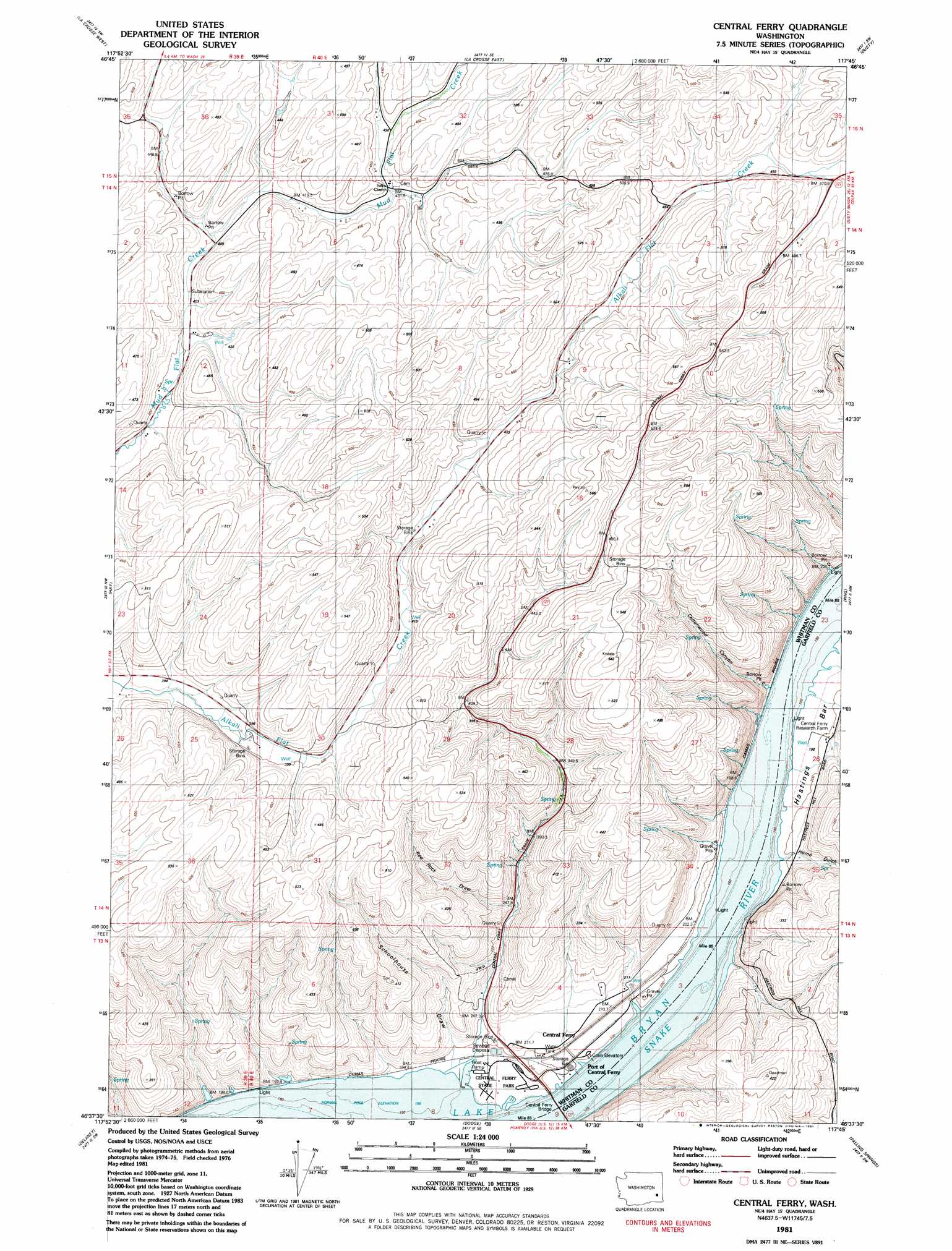
USGS Topo Quad 46117f7 - 1:24,000 scale
| Topo Map Name: | Central Ferry |
| USGS Topo Quad ID: | 46117f7 |
| Print Size: | ca. 21 1/4" wide x 27" high |
| Southeast Coordinates: | 46.625° N latitude / 117.75° W longitude |
| Map Center Coordinates: | 46.6875° N latitude / 117.8125° W longitude |
| U.S. State: | WA |
| Filename: | o46117f7.jpg |
| Download Map JPG Image: | Central Ferry topo map 1:24,000 scale |
| Map Type: | Topographic |
| Topo Series: | 7.5´ |
| Map Scale: | 1:24,000 |
| Source of Map Images: | United States Geological Survey (USGS) |
| Alternate Map Versions: |
Central Ferry WA 1981, updated 1981 Download PDF Buy paper map Central Ferry WA 2011 Download PDF Buy paper map Central Ferry WA 2014 Download PDF Buy paper map |
1:24,000 Topo Quads surrounding Central Ferry
Benge |
Honn Lakes |
Winona |
Endicott |
Thera |
Rattlesnake Canyon |
La Crosse West |
La Crosse East |
Dusty |
Little Penawawa Creek |
Hooper Lake |
Hay |
Central Ferry |
Ping |
Wades Bar |
Starbuck East |
Delaney |
Dodge |
Falling Springs |
Gould City |
Kellogg Creek |
Tucannon |
Turner |
Zumwalt |
Pomeroy |
> Back to 46117e1 at 1:100,000 scale
> Back to 46116a1 at 1:250,000 scale
> Back to U.S. Topo Maps home
Central Ferry topo map: Gazetteer
Central Ferry: Bars
Hastings Bar elevation 198m 649′Central Ferry: Bridges
Central Ferry Bridge elevation 196m 643′Central Ferry: Parks
Central Ferry State Park elevation 197m 646′Central Ferry: Populated Places
Central Ferry elevation 196m 643′Peyton elevation 199m 652′
Purrington elevation 196m 643′
Central Ferry: Valleys
Cottonwood Canyon elevation 197m 646′Hammer Gulch elevation 201m 659′
Home Gulch elevation 201m 659′
Red Rock Draw elevation 241m 790′
Schoolhouse Draw elevation 203m 666′
Central Ferry digital topo map on disk
Buy this Central Ferry topo map showing relief, roads, GPS coordinates and other geographical features, as a high-resolution digital map file on DVD: