Dusty Topo Map Washington
To zoom in, hover over the map of Dusty
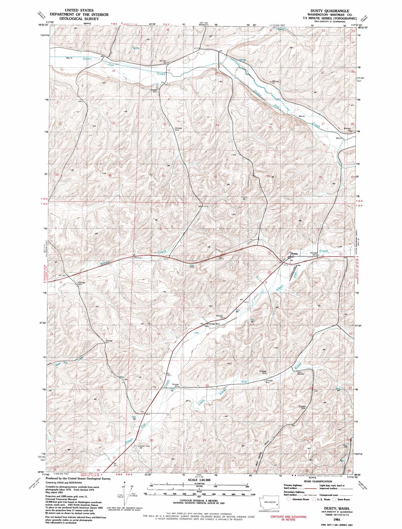
USGS Topo Quad 46117g6 - 1:24,000 scale
| Topo Map Name: | Dusty |
| USGS Topo Quad ID: | 46117g6 |
| Print Size: | ca. 21 1/4" wide x 27" high |
| Southeast Coordinates: | 46.75° N latitude / 117.625° W longitude |
| Map Center Coordinates: | 46.8125° N latitude / 117.6875° W longitude |
| U.S. State: | WA |
| Filename: | o46117g6.jpg |
| Download Map JPG Image: | Dusty topo map 1:24,000 scale |
| Map Type: | Topographic |
| Topo Series: | 7.5´ |
| Map Scale: | 1:24,000 |
| Source of Map Images: | United States Geological Survey (USGS) |
| Alternate Map Versions: |
Dusty WA 1981, updated 1981 Download PDF Buy paper map Dusty WA 2011 Download PDF Buy paper map Dusty WA 2013 Download PDF Buy paper map |
1:24,000 Topo Quads surrounding Dusty
Revere |
Texas Lake |
Ewan |
Saint John |
Thornton |
Honn Lakes |
Winona |
Endicott |
Thera |
Diamond |
La Crosse West |
La Crosse East |
Dusty |
Little Penawawa Creek |
Wilcox |
Hay |
Central Ferry |
Ping |
Wades Bar |
Almota |
Delaney |
Dodge |
Falling Springs |
Gould City |
Kirby |
> Back to 46117e1 at 1:100,000 scale
> Back to 46116a1 at 1:250,000 scale
> Back to U.S. Topo Maps home
Dusty topo map: Gazetteer
Dusty: Populated Places
Dusty elevation 511m 1676′Dusty: Streams
Little Alkali Flat Creek elevation 490m 1607′Dusty digital topo map on disk
Buy this Dusty topo map showing relief, roads, GPS coordinates and other geographical features, as a high-resolution digital map file on DVD: