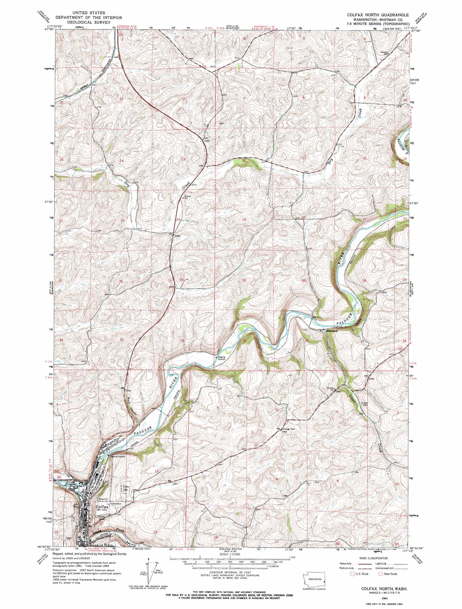
Colfax North Topo Map Washington
To zoom in, hover over the map of Colfax North
USGS Topo Quad 46117h3 - 1:24,000 scale
| Topo Map Name: | Colfax North |
| USGS Topo Quad ID: | 46117h3 |
| Print Size: | ca. 21 1/4" wide x 27" high |
| Southeast Coordinates: | 46.875° N latitude / 117.25° W longitude |
| Map Center Coordinates: | 46.9375° N latitude / 117.3125° W longitude |
| U.S. State: | WA |
| Filename: | o46117h3.jpg |
| Download Map JPG Image: | Colfax North topo map 1:24,000 scale |
| Map Type: | Topographic |
| Topo Series: | 7.5´ |
| Map Scale: | 1:24,000 |
| Source of Map Images: | United States Geological Survey (USGS) |
| Alternate Map Versions: |
Colfax North WA 1964, updated 1965 Download PDF Buy paper map Colfax North WA 2011 Download PDF Buy paper map Colfax North WA 2013 Download PDF Buy paper map |
1:24,000 Topo Quads surrounding Colfax North
Pine City |
Malden |
Rosalia |
Oakesdale |
Tekoa |
Saint John |
Thornton |
Steptoe |
Garfield |
Farmington |
Thera |
Diamond |
Colfax North |
Elberton |
Palouse |
Little Penawawa Creek |
Wilcox |
Colfax South |
Albion |
Viola |
Wades Bar |
Almota |
Ewartsville |
Pullman |
Moscow West |
> Back to 46117e1 at 1:100,000 scale
> Back to 46116a1 at 1:250,000 scale
> Back to U.S. Topo Maps home
Colfax North topo map: Gazetteer
Colfax North: Parks
Colfax Little League Park elevation 601m 1971′Eels Park elevation 634m 2080′
Schmuck Park elevation 601m 1971′
Colfax North: Populated Places
Colfax elevation 601m 1971′Glenwood elevation 633m 2076′
Colfax North: Streams
Clear Creek elevation 629m 2063′South Fork Palouse River elevation 596m 1955′
South Fork Palouse River elevation 597m 1958′
Spring Flat Creek elevation 605m 1984′
Colfax North: Valleys
Buck Canyon elevation 604m 1981′Colfax North digital topo map on disk
Buy this Colfax North topo map showing relief, roads, GPS coordinates and other geographical features, as a high-resolution digital map file on DVD: