Zangar Junction Topo Map Washington
To zoom in, hover over the map of Zangar Junction
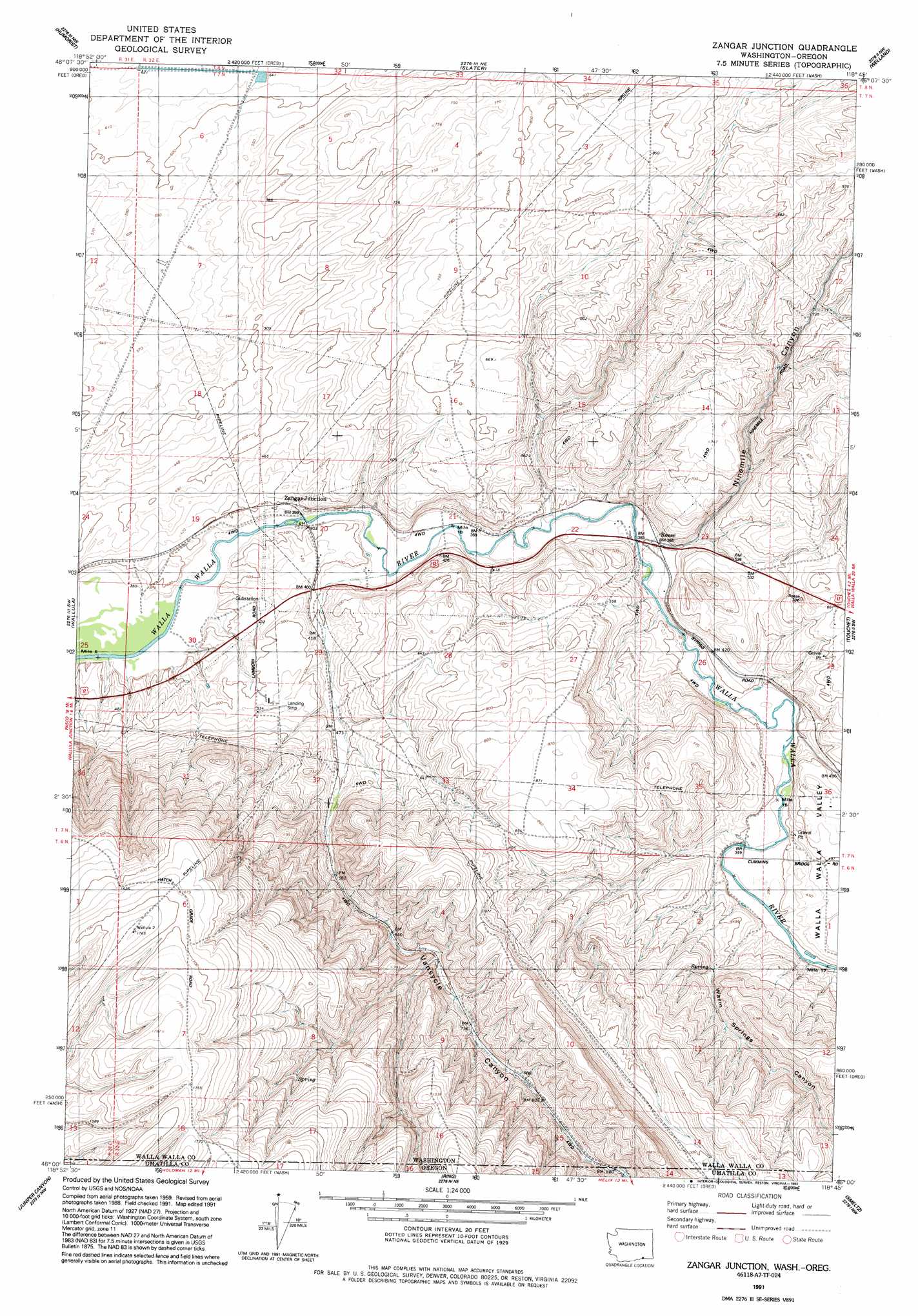
USGS Topo Quad 46118a7 - 1:24,000 scale
| Topo Map Name: | Zangar Junction |
| USGS Topo Quad ID: | 46118a7 |
| Print Size: | ca. 21 1/4" wide x 27" high |
| Southeast Coordinates: | 46° N latitude / 118.75° W longitude |
| Map Center Coordinates: | 46.0625° N latitude / 118.8125° W longitude |
| U.S. States: | WA, OR |
| Filename: | o46118a7.jpg |
| Download Map JPG Image: | Zangar Junction topo map 1:24,000 scale |
| Map Type: | Topographic |
| Topo Series: | 7.5´ |
| Map Scale: | 1:24,000 |
| Source of Map Images: | United States Geological Survey (USGS) |
| Alternate Map Versions: |
Zangar Junction WA 1964, updated 1965 Download PDF Buy paper map Zangar Junction WA 1964, updated 1983 Download PDF Buy paper map Zangar Junction WA 1964, updated 1984 Download PDF Buy paper map Zangar Junction WA 1991, updated 1992 Download PDF Buy paper map Zangar Junction WA 2011 Download PDF Buy paper map Zangar Junction WA 2014 Download PDF Buy paper map |
1:24,000 Topo Quads surrounding Zangar Junction
Glade |
Levey Sw |
Levey Se |
Page |
Eureka |
Pasco |
Humorist |
Slater |
Welland |
Rulo |
Nine Canyon |
Wallula |
Zangar Junction |
Touchet |
Lowden |
Juniper |
Juniper Canyon |
Ring |
Smeltz |
Waterman |
Stanfield Se |
Holdman |
Holdman Se |
Helix |
Adams |
> Back to 46118a1 at 1:100,000 scale
> Back to 46118a1 at 1:250,000 scale
> Back to U.S. Topo Maps home
Zangar Junction topo map: Gazetteer
Zangar Junction: Airports
Compressor Station Number 8 Stolport elevation 167m 547′Zangar Junction: Populated Places
Reese elevation 118m 387′Zangar Junction elevation 123m 403′
Zangar Junction: Valleys
Ninemile Canyon elevation 120m 393′Vansycle Canyon elevation 268m 879′
Vansycle Canyon elevation 105m 344′
Vansycle Canyon elevation 105m 344′
Walla Walla Valley elevation 117m 383′
Walla Walla Valley elevation 117m 383′
Warm Springs Canyon elevation 121m 396′
Warm Springs Canyon elevation 121m 396′
Zangar Junction digital topo map on disk
Buy this Zangar Junction topo map showing relief, roads, GPS coordinates and other geographical features, as a high-resolution digital map file on DVD: