Levey Se Topo Map Washington
To zoom in, hover over the map of Levey Se
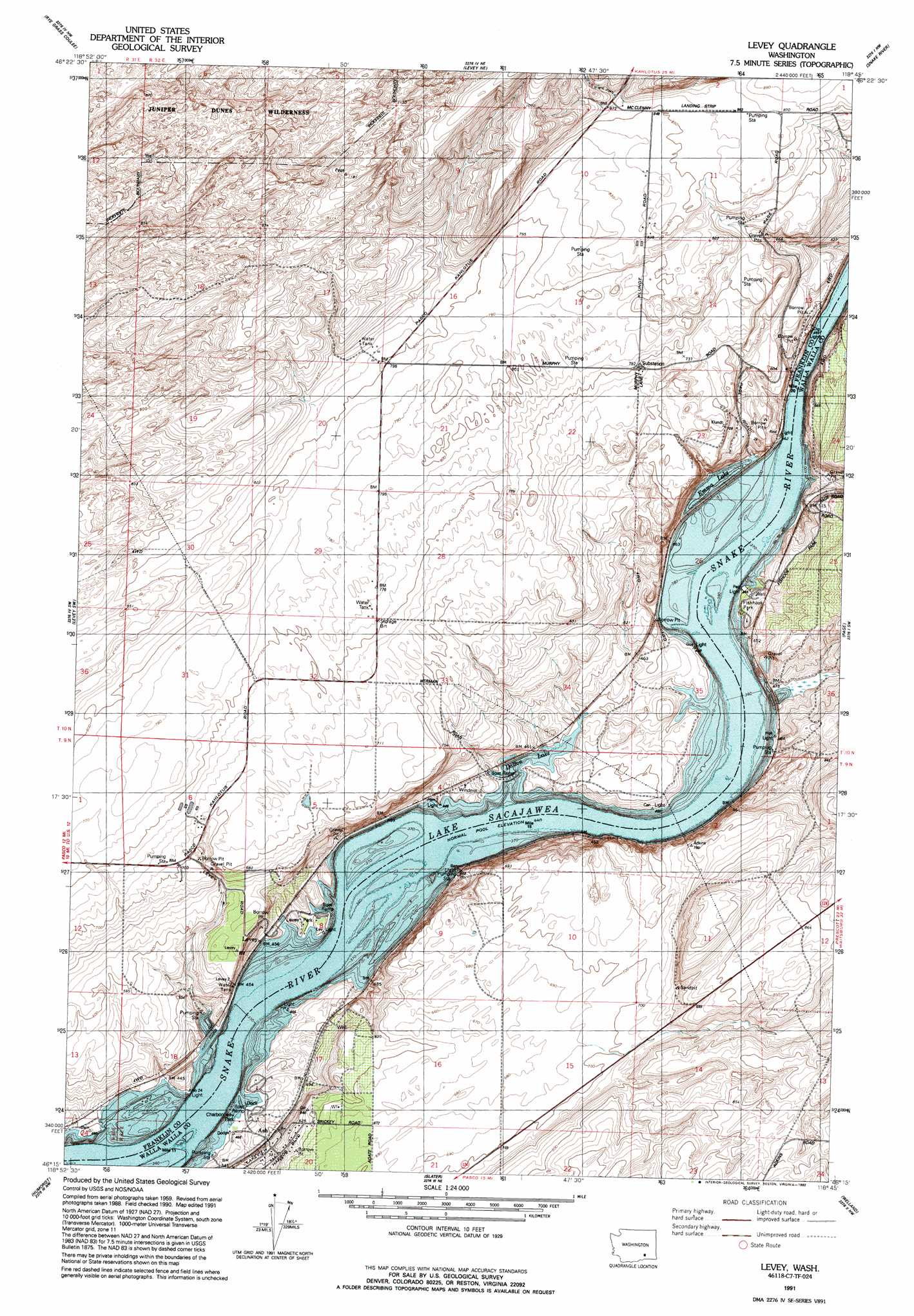
USGS Topo Quad 46118c7 - 1:24,000 scale
| Topo Map Name: | Levey Se |
| USGS Topo Quad ID: | 46118c7 |
| Print Size: | ca. 21 1/4" wide x 27" high |
| Southeast Coordinates: | 46.25° N latitude / 118.75° W longitude |
| Map Center Coordinates: | 46.3125° N latitude / 118.8125° W longitude |
| U.S. State: | WA |
| Filename: | o46118c7.jpg |
| Download Map JPG Image: | Levey Se topo map 1:24,000 scale |
| Map Type: | Topographic |
| Topo Series: | 7.5´ |
| Map Scale: | 1:24,000 |
| Source of Map Images: | United States Geological Survey (USGS) |
| Alternate Map Versions: |
Levey SE WA 1964, updated 1965 Download PDF Buy paper map Levey WA 1991, updated 1992 Download PDF Buy paper map Levey WA 2011 Download PDF Buy paper map Levey WA 2013 Download PDF Buy paper map |
1:24,000 Topo Quads surrounding Levey Se
Mesa West |
Mesa East |
Connell Se |
Burr Canyon |
Lower Monumental Dam |
Eltopia |
Rye Grass Coulee |
Levey Ne |
Snake River |
Elwood |
Glade |
Levey Sw |
Levey Se |
Page |
Eureka |
Pasco |
Humorist |
Slater |
Welland |
Rulo |
Nine Canyon |
Wallula |
Zangar Junction |
Touchet |
Lowden |
> Back to 46118a1 at 1:100,000 scale
> Back to 46118a1 at 1:250,000 scale
> Back to U.S. Topo Maps home
Levey Se topo map: Gazetteer
Levey Se: Areas
Juniper Forest Survival Training Site (historical) elevation 272m 892′Levey Se: Lakes
Emma Lake elevation 135m 442′Levey Se: Parks
Big Flat Habitat Management Unit elevation 160m 524′Charbonneau Park elevation 147m 482′
Charbonneau Recreation Area elevation 138m 452′
Fishhook Park elevation 142m 465′
Levey Landing Park elevation 142m 465′
Levey Se: Populated Places
Ash elevation 152m 498′Levey elevation 138m 452′
Redd elevation 154m 505′
Levey Se: Reservoirs
Dalton Lake elevation 135m 442′Levey Se digital topo map on disk
Buy this Levey Se topo map showing relief, roads, GPS coordinates and other geographical features, as a high-resolution digital map file on DVD: