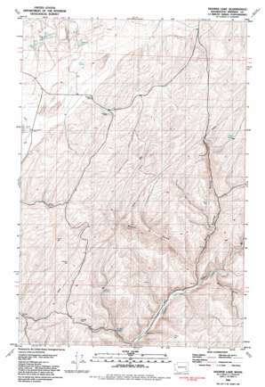
Hooper Lake Topo Map Washington
To zoom in, hover over the map of Hooper Lake
USGS Topo Quad 46118f1 - 1:24,000 scale
| Topo Map Name: | Hooper Lake |
| USGS Topo Quad ID: | 46118f1 |
| Print Size: | ca. 21 1/4" wide x 27" high |
| Southeast Coordinates: | 46.625° N latitude / 118° W longitude |
| Map Center Coordinates: | 46.6875° N latitude / 118.0625° W longitude |
| U.S. State: | WA |
| Filename: | o46118f1.jpg |
| Download Map JPG Image: | Hooper Lake topo map 1:24,000 scale |
| Map Type: | Topographic |
| Topo Series: | 7.5´ |
| Map Scale: | 1:24,000 |
| Source of Map Images: | United States Geological Survey (USGS) |
| Alternate Map Versions: |
Hooper Lake WA 1981, updated 1981 Download PDF Buy paper map Hooper Lake WA 2011 Download PDF Buy paper map Hooper Lake WA 2013 Download PDF Buy paper map |
1:24,000 Topo Quads surrounding Hooper Lake
> Back to 46118e1 at 1:100,000 scale
> Back to 46118a1 at 1:250,000 scale
> Back to U.S. Topo Maps home
Hooper Lake topo map: Gazetteer
Hooper Lake: Lakes
Clear Lake elevation 403m 1322′Hooper Lake elevation 419m 1374′
McGregor Lakes elevation 408m 1338′
Hooper Lake: Springs
Adarria Spring elevation 377m 1236′Goldfish Spring elevation 328m 1076′
Mays Spring elevation 436m 1430′
Rock Spring elevation 472m 1548′
Hooper Lake: Valleys
McCard Gulch elevation 266m 872′Rock Spring Gulch elevation 250m 820′
Woods Gulch elevation 260m 853′
Hooper Lake digital topo map on disk
Buy this Hooper Lake topo map showing relief, roads, GPS coordinates and other geographical features, as a high-resolution digital map file on DVD:


