West Of Washtucna Topo Map Washington
To zoom in, hover over the map of West Of Washtucna
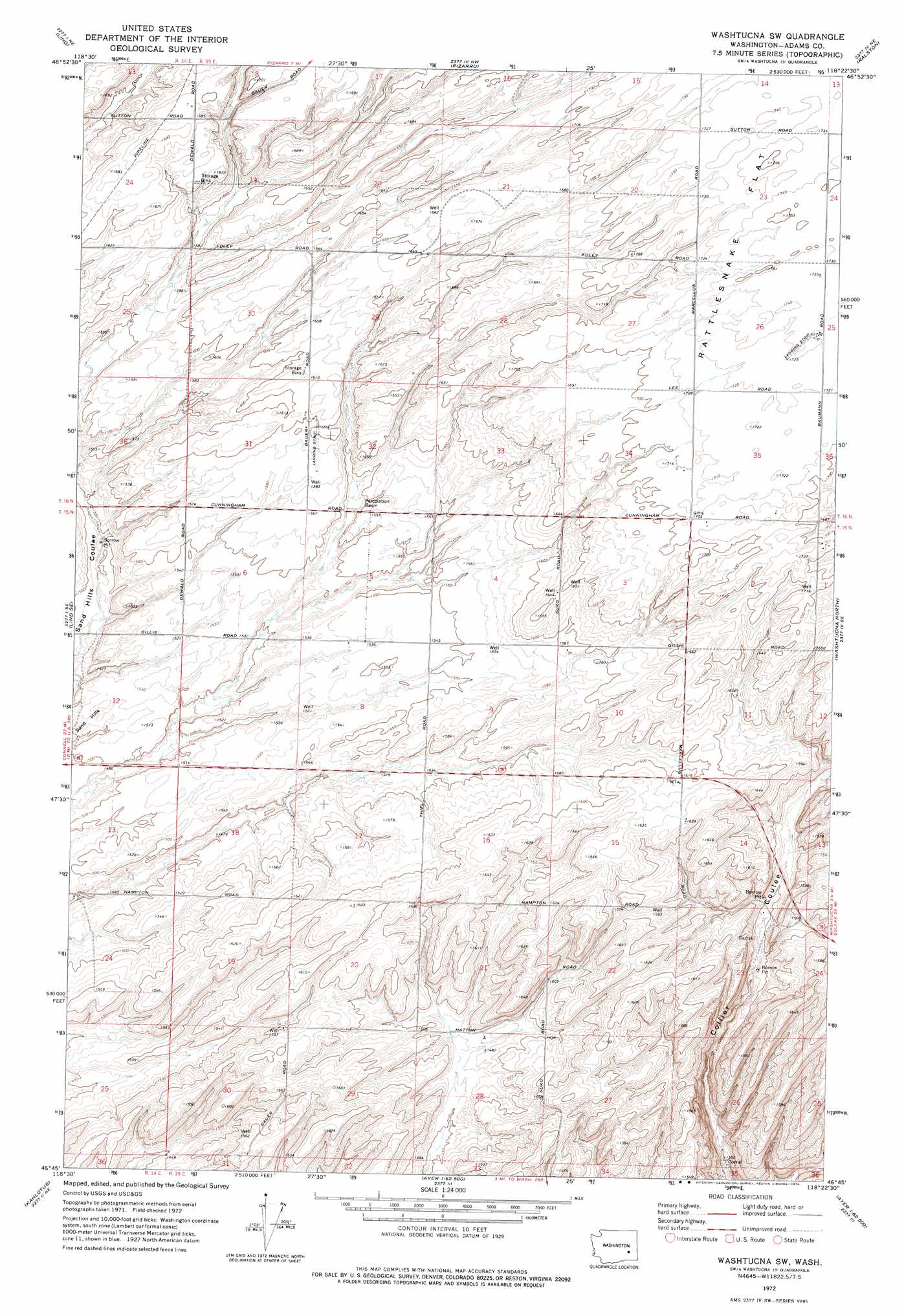
USGS Topo Quad 46118g4 - 1:24,000 scale
| Topo Map Name: | West Of Washtucna |
| USGS Topo Quad ID: | 46118g4 |
| Print Size: | ca. 21 1/4" wide x 27" high |
| Southeast Coordinates: | 46.75° N latitude / 118.375° W longitude |
| Map Center Coordinates: | 46.8125° N latitude / 118.4375° W longitude |
| U.S. State: | WA |
| Filename: | o46118g4.jpg |
| Download Map JPG Image: | West Of Washtucna topo map 1:24,000 scale |
| Map Type: | Topographic |
| Topo Series: | 7.5´ |
| Map Scale: | 1:24,000 |
| Source of Map Images: | United States Geological Survey (USGS) |
| Alternate Map Versions: |
Washtucna SW WA 1972, updated 1974 Download PDF Buy paper map West of Washtucna WA 2011 Download PDF Buy paper map West of Washtucna WA 2013 Download PDF Buy paper map |
1:24,000 Topo Quads surrounding West Of Washtucna
Reiman Sw |
Reiman Se |
Ritzville Sw |
Ritzville Se |
Marengo |
Providence |
Lind |
Pizarro |
Ralston |
Coyote Butte |
Lind Sw |
Lind Se |
West Of Washtucna |
Washtucna North |
Hooper |
Sulphur Lake |
Kahlotus |
Sperry |
Washtucna South |
Palouse Falls |
Burr Canyon |
Lower Monumental Dam |
Monumental Rock |
Ayer |
Starbuck West |
> Back to 46118e1 at 1:100,000 scale
> Back to 46118a1 at 1:250,000 scale
> Back to U.S. Topo Maps home
West Of Washtucna topo map: Gazetteer
West Of Washtucna: Airports
Baumann Farm Incorporated Airport elevation 486m 1594′West Of Washtucna: Flats
Rattlesnake Flat elevation 534m 1751′West Of Washtucna digital topo map on disk
Buy this West Of Washtucna topo map showing relief, roads, GPS coordinates and other geographical features, as a high-resolution digital map file on DVD: