Coyote Butte Topo Map Washington
To zoom in, hover over the map of Coyote Butte
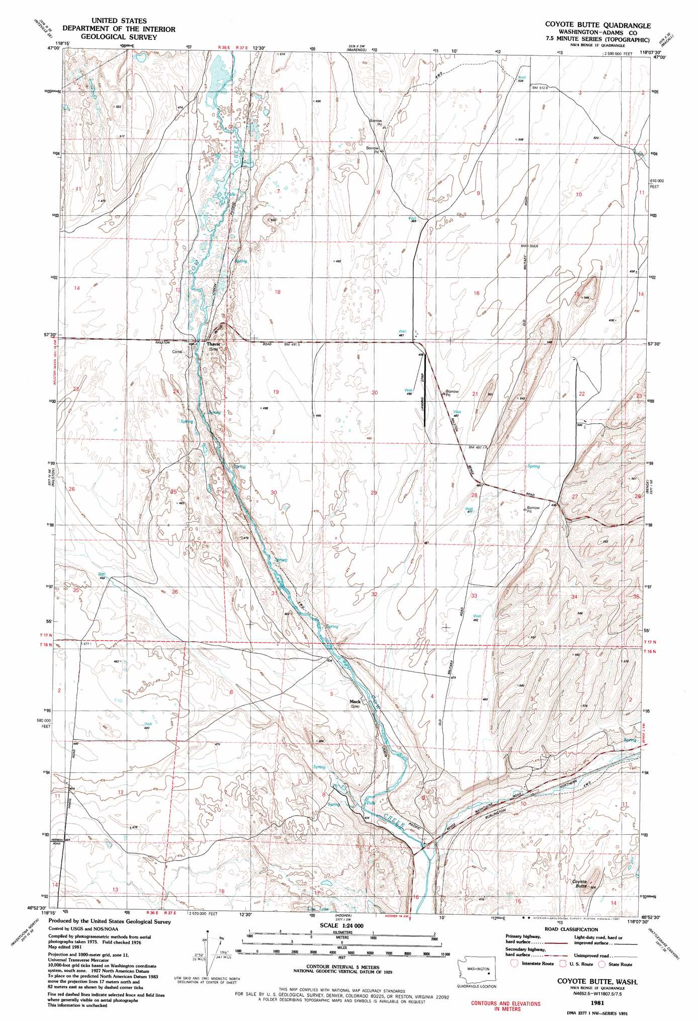
USGS Topo Quad 46118h2 - 1:24,000 scale
| Topo Map Name: | Coyote Butte |
| USGS Topo Quad ID: | 46118h2 |
| Print Size: | ca. 21 1/4" wide x 27" high |
| Southeast Coordinates: | 46.875° N latitude / 118.125° W longitude |
| Map Center Coordinates: | 46.9375° N latitude / 118.1875° W longitude |
| U.S. State: | WA |
| Filename: | o46118h2.jpg |
| Download Map JPG Image: | Coyote Butte topo map 1:24,000 scale |
| Map Type: | Topographic |
| Topo Series: | 7.5´ |
| Map Scale: | 1:24,000 |
| Source of Map Images: | United States Geological Survey (USGS) |
| Alternate Map Versions: |
Coyote Butte WA 1981, updated 1981 Download PDF Buy paper map Coyote Butte WA 2011 Download PDF Buy paper map Coyote Butte WA 2013 Download PDF Buy paper map |
1:24,000 Topo Quads surrounding Coyote Butte
Ritzville Nw |
Ritzville Ne |
Karakul Hills |
Palm Lake |
Lamont |
Ritzville Sw |
Ritzville Se |
Marengo |
Macall |
Revere |
Pizarro |
Ralston |
Coyote Butte |
Benge |
Honn Lakes |
West Of Washtucna |
Washtucna North |
Hooper |
Rattlesnake Canyon |
La Crosse West |
Sperry |
Washtucna South |
Palouse Falls |
Hooper Lake |
Hay |
> Back to 46118e1 at 1:100,000 scale
> Back to 46118a1 at 1:250,000 scale
> Back to U.S. Topo Maps home
Coyote Butte topo map: Gazetteer
Coyote Butte: Airports
Harder Ranch Airport elevation 486m 1594′Coyote Butte: Lakes
Red Lake elevation 487m 1597′Coyote Butte: Populated Places
Mack elevation 431m 1414′Thavis elevation 466m 1528′
Coyote Butte: Summits
Coyote Butte elevation 519m 1702′Terksaleeze Butte elevation 512m 1679′
Coyote Butte digital topo map on disk
Buy this Coyote Butte topo map showing relief, roads, GPS coordinates and other geographical features, as a high-resolution digital map file on DVD: