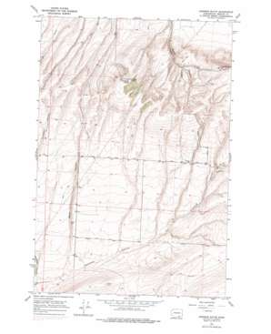
Johnson Butte Topo Map Washington
To zoom in, hover over the map of Johnson Butte
USGS Topo Quad 46119a2 - 1:24,000 scale
| Topo Map Name: | Johnson Butte |
| USGS Topo Quad ID: | 46119a2 |
| Print Size: | ca. 21 1/4" wide x 27" high |
| Southeast Coordinates: | 46° N latitude / 119.125° W longitude |
| Map Center Coordinates: | 46.0625° N latitude / 119.1875° W longitude |
| U.S. State: | WA |
| Filename: | o46119a2.jpg |
| Download Map JPG Image: | Johnson Butte topo map 1:24,000 scale |
| Map Type: | Topographic |
| Topo Series: | 7.5´ |
| Map Scale: | 1:24,000 |
| Source of Map Images: | United States Geological Survey (USGS) |
| Alternate Map Versions: |
Johnson Butte WA 1964, updated 1966 Download PDF Buy paper map Johnson Butte WA 1964, updated 1978 Download PDF Buy paper map Johnson Butte WA 2011 Download PDF Buy paper map Johnson Butte WA 2013 Download PDF Buy paper map |
1:24,000 Topo Quads surrounding Johnson Butte
> Back to 46119a1 at 1:100,000 scale
> Back to 46118a1 at 1:250,000 scale
> Back to U.S. Topo Maps home
Johnson Butte topo map: Gazetteer
Johnson Butte: Dams
Burlingame Dam elevation 371m 1217′Coffin Sheep Dam elevation 343m 1125′
Pat Owens Dam elevation 479m 1571′
Johnson Butte: Summits
Johnson Butte elevation 620m 2034′Jump Off Joe elevation 670m 2198′
Johnson Butte: Valleys
Bofer Canyon elevation 259m 849′Johnson Butte: Wells
Bofer Well elevation 308m 1010′Cresswell Well elevation 415m 1361′
Creswell Well elevation 414m 1358′
Johnson Butte digital topo map on disk
Buy this Johnson Butte topo map showing relief, roads, GPS coordinates and other geographical features, as a high-resolution digital map file on DVD:


