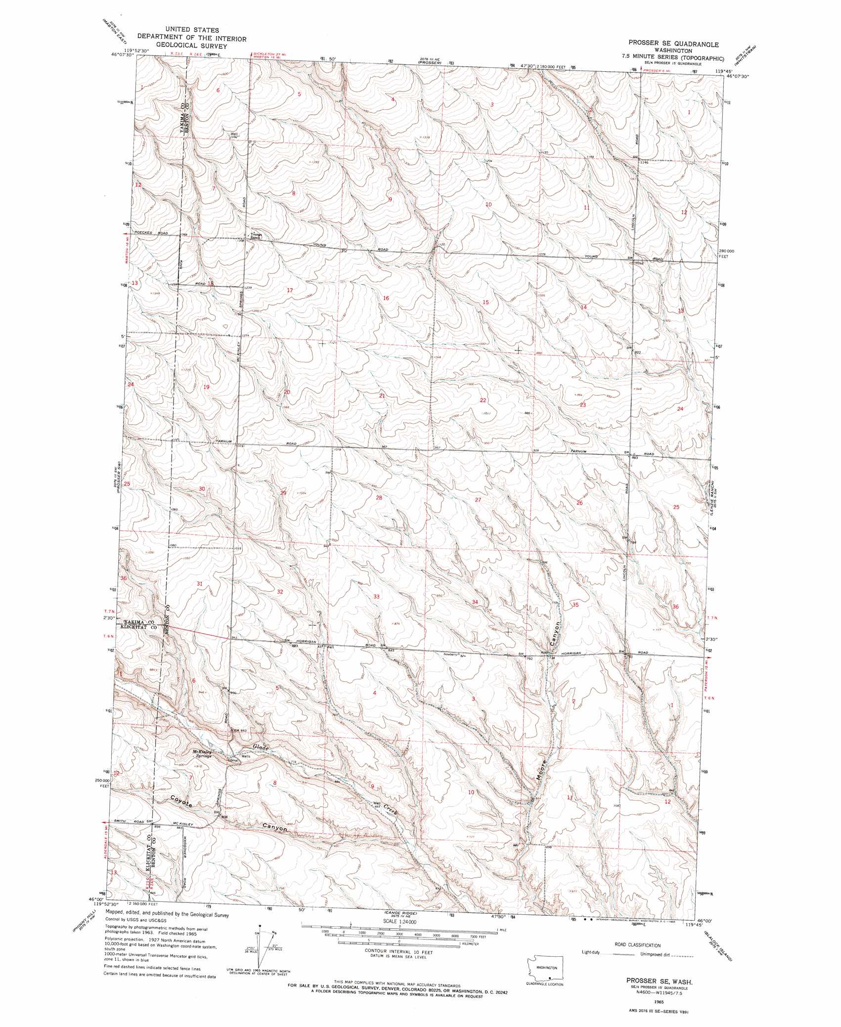
Prosser Se Topo Map Washington
To zoom in, hover over the map of Prosser Se
USGS Topo Quad 46119a7 - 1:24,000 scale
| Topo Map Name: | Prosser Se |
| USGS Topo Quad ID: | 46119a7 |
| Print Size: | ca. 21 1/4" wide x 27" high |
| Southeast Coordinates: | 46° N latitude / 119.75° W longitude |
| Map Center Coordinates: | 46.0625° N latitude / 119.8125° W longitude |
| U.S. State: | WA |
| Filename: | o46119a7.jpg |
| Download Map JPG Image: | Prosser Se topo map 1:24,000 scale |
| Map Type: | Topographic |
| Topo Series: | 7.5´ |
| Map Scale: | 1:24,000 |
| Source of Map Images: | United States Geological Survey (USGS) |
| Alternate Map Versions: |
Prosser SE WA 1965, updated 1966 Download PDF Buy paper map Prosser SE WA 2011 Download PDF Buy paper map Prosser SE WA 2013 Download PDF Buy paper map |
1:24,000 Topo Quads surrounding Prosser Se
Sunnyside |
Grandview |
Sagebrush Ridge |
Snipes Creek |
Corral Canyon |
Mabton West |
Mabton East |
Prosser |
Whitstran |
Whitstran Ne |
Tule Prong |
Prosser Sw |
Prosser Se |
Lenzie Ranch |
Whitstran Se |
Douty Canyon |
Phinny Hill |
Canoe Ridge |
Blalock Island |
Paterson |
Heppner Junction |
Alderdale |
Crow Butte |
Boardman |
Clarke |
> Back to 46119a1 at 1:100,000 scale
> Back to 46118a1 at 1:250,000 scale
> Back to U.S. Topo Maps home
Prosser Se topo map: Gazetteer
Prosser Se: Springs
McKinley Springs elevation 234m 767′Prosser Se: Valleys
Coyote Canyon elevation 196m 643′Prosser Se digital topo map on disk
Buy this Prosser Se topo map showing relief, roads, GPS coordinates and other geographical features, as a high-resolution digital map file on DVD: