Sagebrush Ridge Topo Map Washington
To zoom in, hover over the map of Sagebrush Ridge
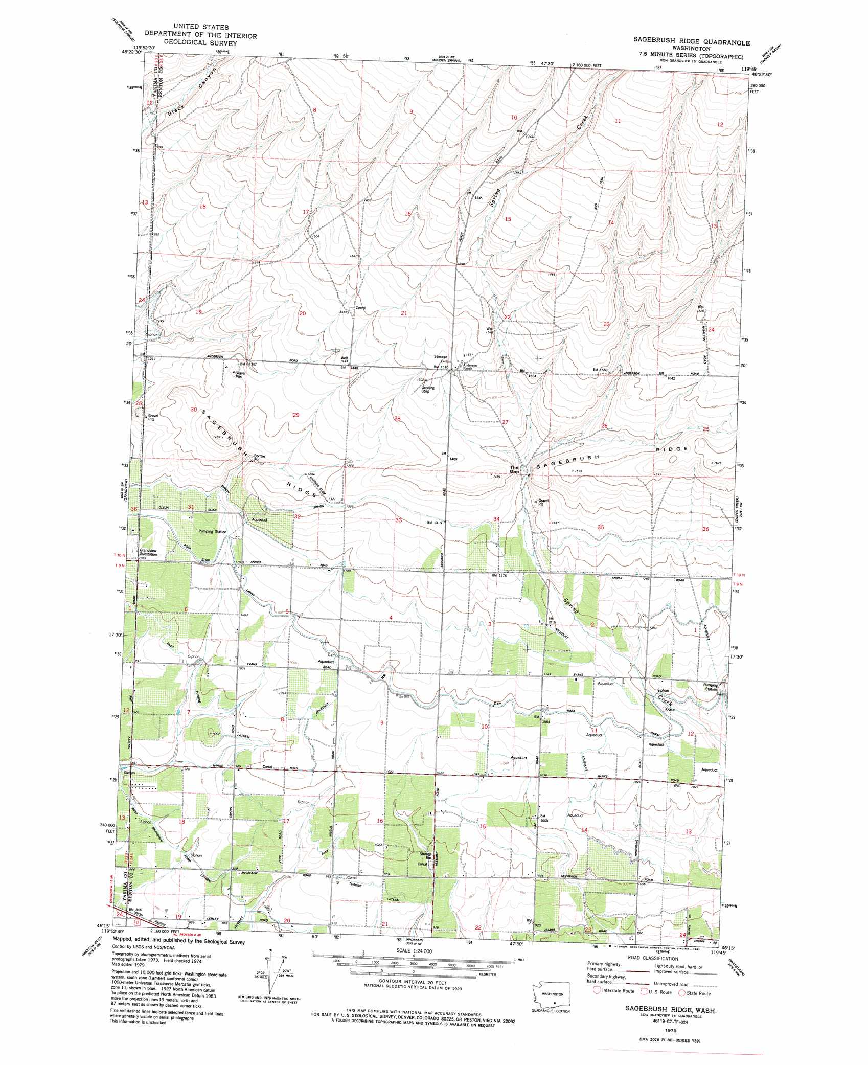
USGS Topo Quad 46119c7 - 1:24,000 scale
| Topo Map Name: | Sagebrush Ridge |
| USGS Topo Quad ID: | 46119c7 |
| Print Size: | ca. 21 1/4" wide x 27" high |
| Southeast Coordinates: | 46.25° N latitude / 119.75° W longitude |
| Map Center Coordinates: | 46.3125° N latitude / 119.8125° W longitude |
| U.S. State: | WA |
| Filename: | o46119c7.jpg |
| Download Map JPG Image: | Sagebrush Ridge topo map 1:24,000 scale |
| Map Type: | Topographic |
| Topo Series: | 7.5´ |
| Map Scale: | 1:24,000 |
| Source of Map Images: | United States Geological Survey (USGS) |
| Alternate Map Versions: |
Sagebrush Ridge WA 1979, updated 1980 Download PDF Buy paper map Sagebrush Ridge WA 1979, updated 1987 Download PDF Buy paper map Sagebrush Ridge WA 2011 Download PDF Buy paper map Sagebrush Ridge WA 2013 Download PDF Buy paper map |
1:24,000 Topo Quads surrounding Sagebrush Ridge
Black Rock Spring |
Cairn Hope Peak |
Emerson Nipple |
Riverland |
Gable Butte |
Granger Ne |
Sulphur Spring |
Maiden Spring |
Snively Basin |
Iowa Flats |
Sunnyside |
Grandview |
Sagebrush Ridge |
Snipes Creek |
Corral Canyon |
Mabton West |
Mabton East |
Prosser |
Whitstran |
Whitstran Ne |
Tule Prong |
Prosser Sw |
Prosser Se |
Lenzie Ranch |
Whitstran Se |
> Back to 46119a1 at 1:100,000 scale
> Back to 46118a1 at 1:250,000 scale
> Back to U.S. Topo Maps home
Sagebrush Ridge topo map: Gazetteer
Sagebrush Ridge: Canals
West Grandview Lateral elevation 276m 905′Sagebrush Ridge: Gaps
The Gap elevation 403m 1322′Sagebrush Ridge: Ridges
Sagebrush Ridge elevation 462m 1515′Sagebrush Ridge digital topo map on disk
Buy this Sagebrush Ridge topo map showing relief, roads, GPS coordinates and other geographical features, as a high-resolution digital map file on DVD: