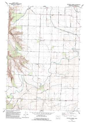
Mathews Corner Topo Map Washington
To zoom in, hover over the map of Mathews Corner
USGS Topo Quad 46119d2 - 1:24,000 scale
| Topo Map Name: | Mathews Corner |
| USGS Topo Quad ID: | 46119d2 |
| Print Size: | ca. 21 1/4" wide x 27" high |
| Southeast Coordinates: | 46.375° N latitude / 119.125° W longitude |
| Map Center Coordinates: | 46.4375° N latitude / 119.1875° W longitude |
| U.S. State: | WA |
| Filename: | o46119d2.jpg |
| Download Map JPG Image: | Mathews Corner topo map 1:24,000 scale |
| Map Type: | Topographic |
| Topo Series: | 7.5´ |
| Map Scale: | 1:24,000 |
| Source of Map Images: | United States Geological Survey (USGS) |
| Alternate Map Versions: |
Mathews Corner WA 1975, updated 1977 Download PDF Buy paper map Mathews Corner WA 1992, updated 1992 Download PDF Buy paper map Mathews Corner WA 2011 Download PDF Buy paper map Mathews Corner WA 2014 Download PDF Buy paper map |
1:24,000 Topo Quads surrounding Mathews Corner
> Back to 46119a1 at 1:100,000 scale
> Back to 46118a1 at 1:250,000 scale
> Back to U.S. Topo Maps home
Mathews Corner topo map: Gazetteer
Mathews Corner: Canals
Eltopia Branch Canal elevation 270m 885′Ringold Wasteway elevation 271m 889′
Mathews Corner: Populated Places
Mathews Corner elevation 282m 925′Mathews Corner digital topo map on disk
Buy this Mathews Corner topo map showing relief, roads, GPS coordinates and other geographical features, as a high-resolution digital map file on DVD:


