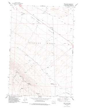
Iowa Flats Topo Map Washington
To zoom in, hover over the map of Iowa Flats
USGS Topo Quad 46119d5 - 1:24,000 scale
| Topo Map Name: | Iowa Flats |
| USGS Topo Quad ID: | 46119d5 |
| Print Size: | ca. 21 1/4" wide x 27" high |
| Southeast Coordinates: | 46.375° N latitude / 119.5° W longitude |
| Map Center Coordinates: | 46.4375° N latitude / 119.5625° W longitude |
| U.S. State: | WA |
| Filename: | o46119d5.jpg |
| Download Map JPG Image: | Iowa Flats topo map 1:24,000 scale |
| Map Type: | Topographic |
| Topo Series: | 7.5´ |
| Map Scale: | 1:24,000 |
| Source of Map Images: | United States Geological Survey (USGS) |
| Alternate Map Versions: |
Iowa Flats WA 1974, updated 1977 Download PDF Buy paper map Iowa Flats WA 2011 Download PDF Buy paper map Iowa Flats WA 2013 Download PDF Buy paper map |
1:24,000 Topo Quads surrounding Iowa Flats
> Back to 46119a1 at 1:100,000 scale
> Back to 46118a1 at 1:250,000 scale
> Back to U.S. Topo Maps home
Iowa Flats topo map: Gazetteer
Iowa Flats: Areas
Rattlesnake Hills Research Natural Area elevation 295m 967′Iowa Flats: Flats
Iowa Flats elevation 338m 1108′Iowa Flats: Springs
Sam White Spring elevation 820m 2690′Iowa Flats: Summits
Goose Egg Hill elevation 186m 610′Rattlesnake Mountain elevation 1076m 3530′
Iowa Flats digital topo map on disk
Buy this Iowa Flats topo map showing relief, roads, GPS coordinates and other geographical features, as a high-resolution digital map file on DVD:


