Othello Topo Map Washington
To zoom in, hover over the map of Othello
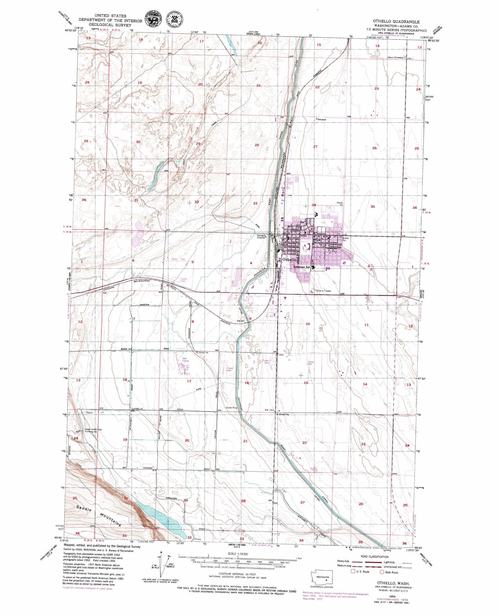
USGS Topo Quad 46119g2 - 1:24,000 scale
| Topo Map Name: | Othello |
| USGS Topo Quad ID: | 46119g2 |
| Print Size: | ca. 21 1/4" wide x 27" high |
| Southeast Coordinates: | 46.75° N latitude / 119.125° W longitude |
| Map Center Coordinates: | 46.8125° N latitude / 119.1875° W longitude |
| U.S. State: | WA |
| Filename: | o46119g2.jpg |
| Download Map JPG Image: | Othello topo map 1:24,000 scale |
| Map Type: | Topographic |
| Topo Series: | 7.5´ |
| Map Scale: | 1:24,000 |
| Source of Map Images: | United States Geological Survey (USGS) |
| Alternate Map Versions: |
Othello WA 1954, updated 1956 Download PDF Buy paper map Othello WA 1954, updated 1979 Download PDF Buy paper map Othello WA 2011 Download PDF Buy paper map Othello WA 2014 Download PDF Buy paper map |
1:24,000 Topo Quads surrounding Othello
Mae |
Moses Lake South |
Sieler |
Bassett Junction |
Weber |
Royal Camp |
O'Sullivan Dam |
Soda Lake |
Warden |
Hatton Nw |
Corfu |
Taunton |
Othello |
Bruce |
Shano |
Locke Island |
Hanford Ne |
Eagle Lakes |
Scooteney Reservoir |
Frischknecht |
Hanford |
Savage Island |
Basin City |
Mesa West |
Mesa East |
> Back to 46119e1 at 1:100,000 scale
> Back to 46118a1 at 1:250,000 scale
> Back to U.S. Topo Maps home
Othello topo map: Gazetteer
Othello: Airports
Gearheart Private Airport elevation 286m 938′Kent Farms Airport elevation 354m 1161′
Taggares Field elevation 351m 1151′
Othello: Dams
Taggares Dam Number Four elevation 285m 935′Taggares Dam Number One elevation 267m 875′
Taggares Dam Number Three elevation 272m 892′
Taggares Dam Number Two elevation 267m 875′
Othello: Populated Places
Othello elevation 323m 1059′Othello digital topo map on disk
Buy this Othello topo map showing relief, roads, GPS coordinates and other geographical features, as a high-resolution digital map file on DVD: