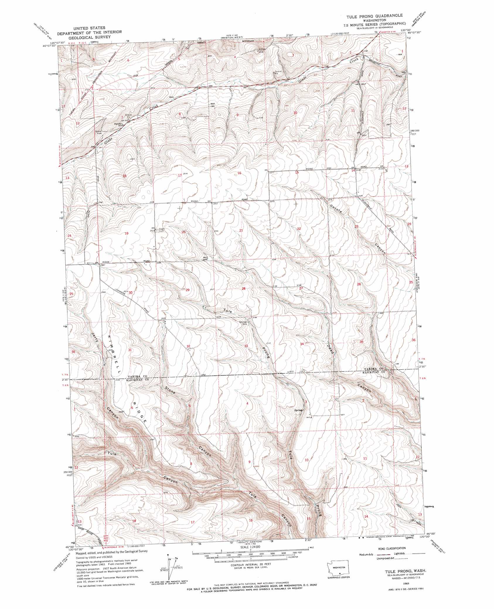
Tule Prong Topo Map Washington
To zoom in, hover over the map of Tule Prong
USGS Topo Quad 46120a1 - 1:24,000 scale
| Topo Map Name: | Tule Prong |
| USGS Topo Quad ID: | 46120a1 |
| Print Size: | ca. 21 1/4" wide x 27" high |
| Southeast Coordinates: | 46° N latitude / 120° W longitude |
| Map Center Coordinates: | 46.0625° N latitude / 120.0625° W longitude |
| U.S. State: | WA |
| Filename: | o46120a1.jpg |
| Download Map JPG Image: | Tule Prong topo map 1:24,000 scale |
| Map Type: | Topographic |
| Topo Series: | 7.5´ |
| Map Scale: | 1:24,000 |
| Source of Map Images: | United States Geological Survey (USGS) |
| Alternate Map Versions: |
Tule Prong WA 1965, updated 1966 Download PDF Buy paper map Tule Prong WA 2011 Download PDF Buy paper map Tule Prong WA 2013 Download PDF Buy paper map |
1:24,000 Topo Quads surrounding Tule Prong
Hembre Mountain |
Granger |
Sunnyside |
Grandview |
Sagebrush Ridge |
Poisel Butte |
Bluelight Nw |
Mabton West |
Mabton East |
Prosser |
Poisel Butte Se |
Bluelight |
Tule Prong |
Prosser Sw |
Prosser Se |
Bickleton |
Crider Valley |
Douty Canyon |
Phinny Hill |
Canoe Ridge |
Dot |
Wood Gulch |
Heppner Junction |
Alderdale |
Crow Butte |
> Back to 46120a1 at 1:100,000 scale
> Back to 46120a1 at 1:250,000 scale
> Back to U.S. Topo Maps home
Tule Prong topo map: Gazetteer
Tule Prong: Ridges
Kimbrell Ridge elevation 736m 2414′Tule Prong: Valleys
Jerry Canyon elevation 560m 1837′Stone Canyon elevation 477m 1564′
Tule Prong digital topo map on disk
Buy this Tule Prong topo map showing relief, roads, GPS coordinates and other geographical features, as a high-resolution digital map file on DVD: