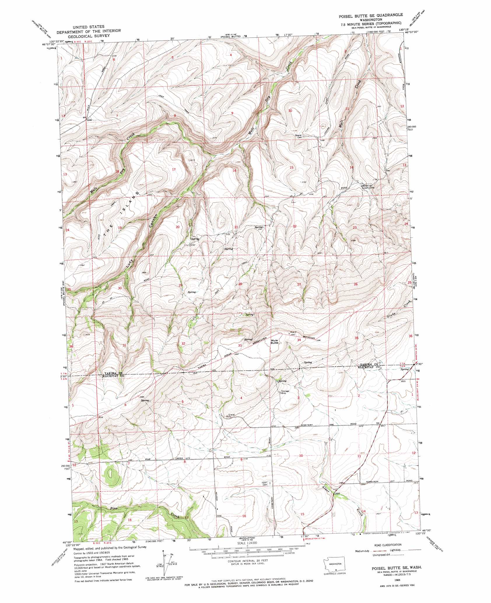
Poisel Butte Se Topo Map Washington
To zoom in, hover over the map of Poisel Butte Se
USGS Topo Quad 46120a3 - 1:24,000 scale
| Topo Map Name: | Poisel Butte Se |
| USGS Topo Quad ID: | 46120a3 |
| Print Size: | ca. 21 1/4" wide x 27" high |
| Southeast Coordinates: | 46° N latitude / 120.25° W longitude |
| Map Center Coordinates: | 46.0625° N latitude / 120.3125° W longitude |
| U.S. State: | WA |
| Filename: | o46120a3.jpg |
| Download Map JPG Image: | Poisel Butte Se topo map 1:24,000 scale |
| Map Type: | Topographic |
| Topo Series: | 7.5´ |
| Map Scale: | 1:24,000 |
| Source of Map Images: | United States Geological Survey (USGS) |
| Alternate Map Versions: |
Poisel Butte SE WA 1965, updated 1967 Download PDF Buy paper map Poisel Butte SE WA 2011 Download PDF Buy paper map Poisel Butte SE WA 2013 Download PDF Buy paper map |
1:24,000 Topo Quads surrounding Poisel Butte Se
Harrah Se |
Toppenish Sw |
Hembre Mountain |
Granger |
Sunnyside |
Logy Creek Ne |
Poisel Butte Nw |
Poisel Butte |
Bluelight Nw |
Mabton West |
Kusshi Creek |
Poisel Butte Sw |
Poisel Butte Se |
Bluelight |
Tule Prong |
Lone Pine Butte |
Bickleton Nw |
Bickleton |
Crider Valley |
Douty Canyon |
Luna Gulch |
Goodnoe Hills |
Dot |
Wood Gulch |
Heppner Junction |
> Back to 46120a1 at 1:100,000 scale
> Back to 46120a1 at 1:250,000 scale
> Back to U.S. Topo Maps home
Poisel Butte Se topo map: Gazetteer
Poisel Butte Se: Summits
Mule Butte elevation 1132m 3713′The Island elevation 806m 2644′
Poisel Butte Se: Valleys
Lucy Canyon elevation 578m 1896′Poisel Butte Se digital topo map on disk
Buy this Poisel Butte Se topo map showing relief, roads, GPS coordinates and other geographical features, as a high-resolution digital map file on DVD: