Logy Creek Falls Topo Map Washington
To zoom in, hover over the map of Logy Creek Falls
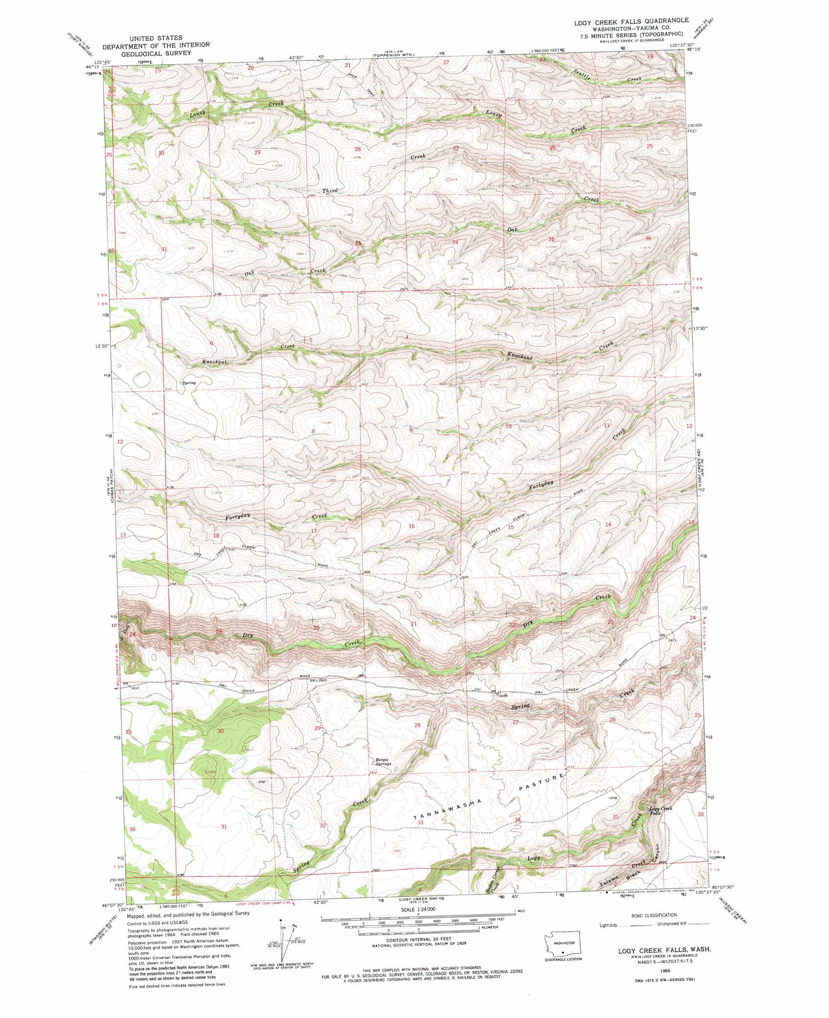
USGS Topo Quad 46120b6 - 1:24,000 scale
| Topo Map Name: | Logy Creek Falls |
| USGS Topo Quad ID: | 46120b6 |
| Print Size: | ca. 21 1/4" wide x 27" high |
| Southeast Coordinates: | 46.125° N latitude / 120.625° W longitude |
| Map Center Coordinates: | 46.1875° N latitude / 120.6875° W longitude |
| U.S. State: | WA |
| Filename: | o46120b6.jpg |
| Download Map JPG Image: | Logy Creek Falls topo map 1:24,000 scale |
| Map Type: | Topographic |
| Topo Series: | 7.5´ |
| Map Scale: | 1:24,000 |
| Source of Map Images: | United States Geological Survey (USGS) |
| Alternate Map Versions: |
Logy Creek Falls WA 1965, updated 1966 Download PDF Buy paper map Logy Creek Falls WA 1965, updated 1983 Download PDF Buy paper map Logy Creek Falls WA 2011 Download PDF Buy paper map Logy Creek Falls WA 2013 Download PDF Buy paper map |
1:24,000 Topo Quads surrounding Logy Creek Falls
Yesmowit Canyon |
Medicine Valley |
White Swan |
Harrah |
Wapato |
Willy Dick Canyon |
Fort Simcoe |
Toppenish Mountain |
Harrah Se |
Toppenish Sw |
Mckays Butte |
Camas Patch |
Logy Creek Falls |
Logy Creek Ne |
Poisel Butte Nw |
Hagerty Butte |
Stagman Butte |
Logy Creek Sw |
Kusshi Creek |
Poisel Butte Sw |
White Pine Buttes |
Indian Rock |
Status Pass |
Lone Pine Butte |
Bickleton Nw |
> Back to 46120a1 at 1:100,000 scale
> Back to 46120a1 at 1:250,000 scale
> Back to U.S. Topo Maps home
Logy Creek Falls topo map: Gazetteer
Logy Creek Falls: Falls
Logy Creek Falls elevation 697m 2286′Logy Creek Falls: Flats
Tannawasha Pasture elevation 858m 2814′Logy Creek Falls: Springs
Bergie Springs elevation 885m 2903′Logy Creek Falls: Streams
Section Corner Creek elevation 779m 2555′Third Creek elevation 575m 1886′
Yatama Creek elevation 698m 2290′
Logy Creek Falls: Valleys
Black Canyon elevation 696m 2283′Logy Creek Falls digital topo map on disk
Buy this Logy Creek Falls topo map showing relief, roads, GPS coordinates and other geographical features, as a high-resolution digital map file on DVD: