Granger Ne Topo Map Washington
To zoom in, hover over the map of Granger Ne
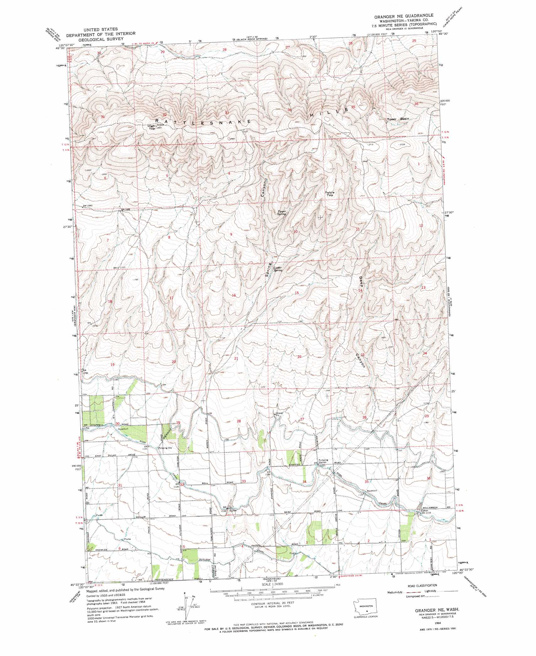
USGS Topo Quad 46120d1 - 1:24,000 scale
| Topo Map Name: | Granger Ne |
| USGS Topo Quad ID: | 46120d1 |
| Print Size: | ca. 21 1/4" wide x 27" high |
| Southeast Coordinates: | 46.375° N latitude / 120° W longitude |
| Map Center Coordinates: | 46.4375° N latitude / 120.0625° W longitude |
| U.S. State: | WA |
| Filename: | o46120d1.jpg |
| Download Map JPG Image: | Granger Ne topo map 1:24,000 scale |
| Map Type: | Topographic |
| Topo Series: | 7.5´ |
| Map Scale: | 1:24,000 |
| Source of Map Images: | United States Geological Survey (USGS) |
| Alternate Map Versions: |
Granger NE WA 1964, updated 1966 Download PDF Buy paper map Granger NE WA 2011 Download PDF Buy paper map Granger NE WA 2013 Download PDF Buy paper map |
1:24,000 Topo Quads surrounding Granger Ne
Selah Springs |
Black Rock Spring Nw |
Black Rock Spring Ne |
Priest Rapids |
Priest Rapids Ne |
Elephant Mountain |
Black Rock Spring Sw |
Black Rock Spring |
Cairn Hope Peak |
Emerson Nipple |
Toppenish |
Granger Nw |
Granger Ne |
Sulphur Spring |
Maiden Spring |
Hembre Mountain |
Granger |
Sunnyside |
Grandview |
Sagebrush Ridge |
Poisel Butte |
Bluelight Nw |
Mabton West |
Mabton East |
Prosser |
> Back to 46120a1 at 1:100,000 scale
> Back to 46120a1 at 1:250,000 scale
> Back to U.S. Topo Maps home
Granger Ne topo map: Gazetteer
Granger Ne: Basins
Tower Basin elevation 771m 2529′Granger Ne: Capes
Table Top elevation 794m 2604′Granger Ne: Dams
Callison Dam elevation 348m 1141′Granger Ne: Springs
Lower Spring elevation 543m 1781′Upper Spring elevation 638m 2093′
Granger Ne: Summits
High Top elevation 915m 3001′Granger Ne: Valleys
Deep Canyon elevation 401m 1315′Spring Canyon elevation 482m 1581′
Granger Ne digital topo map on disk
Buy this Granger Ne topo map showing relief, roads, GPS coordinates and other geographical features, as a high-resolution digital map file on DVD: