Granger Nw Topo Map Washington
To zoom in, hover over the map of Granger Nw
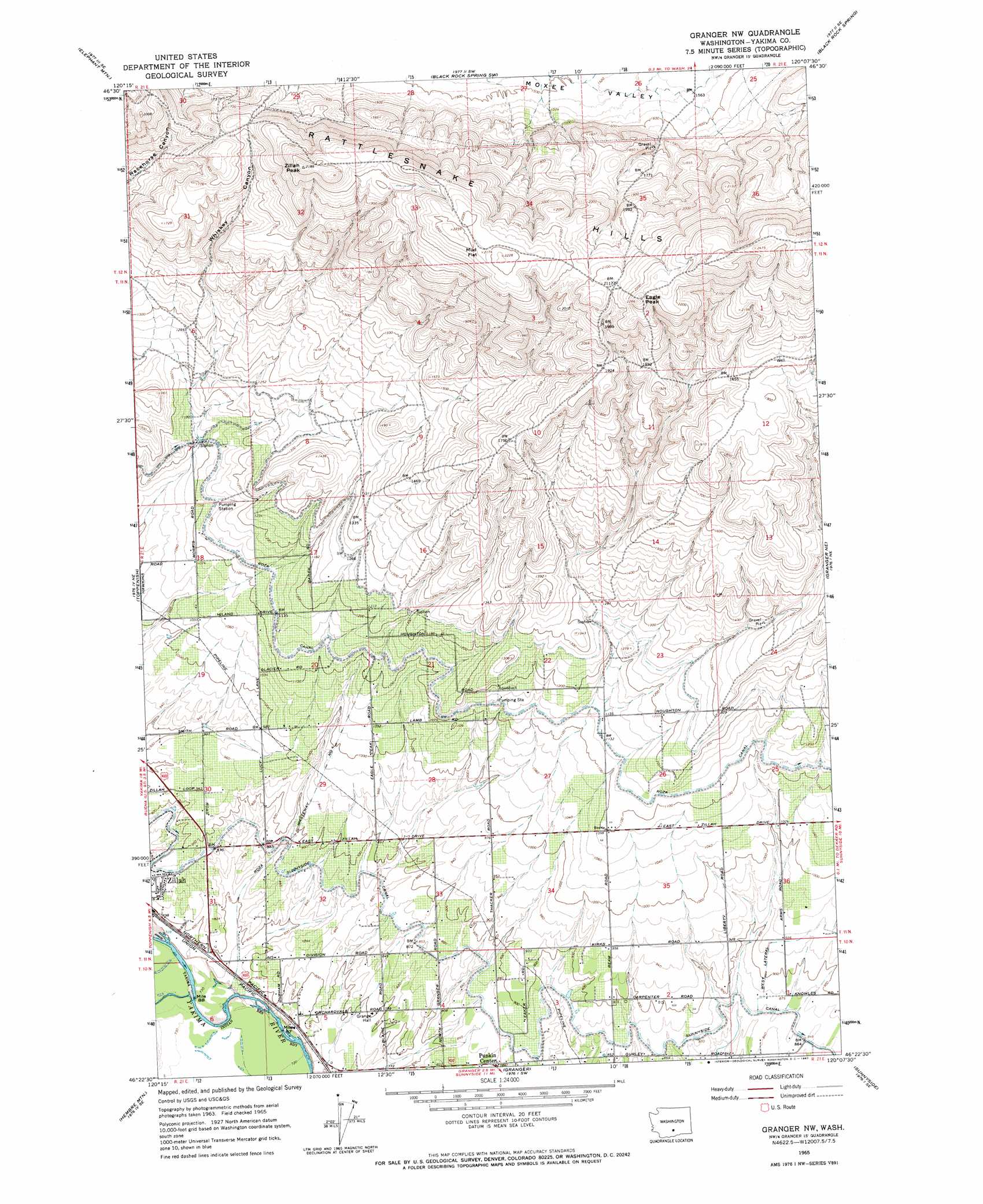
USGS Topo Quad 46120d2 - 1:24,000 scale
| Topo Map Name: | Granger Nw |
| USGS Topo Quad ID: | 46120d2 |
| Print Size: | ca. 21 1/4" wide x 27" high |
| Southeast Coordinates: | 46.375° N latitude / 120.125° W longitude |
| Map Center Coordinates: | 46.4375° N latitude / 120.1875° W longitude |
| U.S. State: | WA |
| Filename: | o46120d2.jpg |
| Download Map JPG Image: | Granger Nw topo map 1:24,000 scale |
| Map Type: | Topographic |
| Topo Series: | 7.5´ |
| Map Scale: | 1:24,000 |
| Source of Map Images: | United States Geological Survey (USGS) |
| Alternate Map Versions: |
Granger NW WA 1965, updated 1967 Download PDF Buy paper map Granger NW WA 2011 Download PDF Buy paper map Granger NW WA 2013 Download PDF Buy paper map |
1:24,000 Topo Quads surrounding Granger Nw
Pomona |
Selah Springs |
Black Rock Spring Nw |
Black Rock Spring Ne |
Priest Rapids |
Yakima East |
Elephant Mountain |
Black Rock Spring Sw |
Black Rock Spring |
Cairn Hope Peak |
Wapato |
Toppenish |
Granger Nw |
Granger Ne |
Sulphur Spring |
Toppenish Sw |
Hembre Mountain |
Granger |
Sunnyside |
Grandview |
Poisel Butte Nw |
Poisel Butte |
Bluelight Nw |
Mabton West |
Mabton East |
> Back to 46120a1 at 1:100,000 scale
> Back to 46120a1 at 1:250,000 scale
> Back to U.S. Topo Maps home
Granger Nw topo map: Gazetteer
Granger Nw: Airports
McMahon Field elevation 248m 813′Granger Nw: Canals
Roza Wasteway Number 4 elevation 289m 948′West Lateral elevation 284m 931′
Granger Nw: Dams
Bunger Dam elevation 303m 994′Granger Nw: Summits
Eagle Peak elevation 696m 2283′Zillah Peak elevation 666m 2185′
Granger Nw: Valleys
Whiskey Canyon elevation 384m 1259′Granger Nw digital topo map on disk
Buy this Granger Nw topo map showing relief, roads, GPS coordinates and other geographical features, as a high-resolution digital map file on DVD: